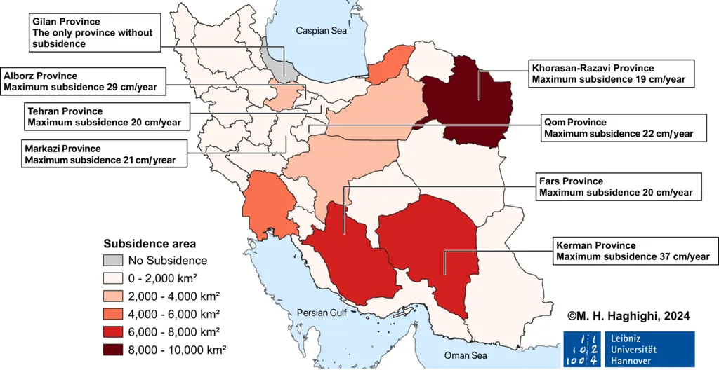
In the heart of Iran’s Isfahan-Borkhar region, a silent but formidable threat looms beneath the surface: land subsidence. This gradual sinking of the Earth’s crust, driven by a mix of natural and human-induced factors, poses significant risks to infrastructure, agriculture, and cultural heritage. A recent study led by Negar Ghasemi, an M.Sc. Student in Remote Sensing at the University of Isfahan, sheds light on this critical issue, offering a roadmap for mitigation and informed decision-making.
Ghasemi and her team employed advanced remote sensing techniques, specifically radar interferometry (InSAR) using 145 Sentinel-1 satellite images, to monitor subsidence rates over a five-year period (2019-2023). The study, published in the *Journal of Stratigraphy and Sedimentology Researches* (translated from Persian as *Journal of Stratigraphy and Sedimentology Researches*), leveraged machine learning algorithms to develop a comprehensive susceptibility map, dividing the region into five risk categories.
The team tested three machine learning algorithms: Decision Tree (DT), Random Forest (RF), and Extreme Gradient Boosting (XGBoost). Among these, Random Forest emerged as the most effective, achieving a classification accuracy of 95.63%. “The Random Forest algorithm not only provided the highest accuracy but also successfully mapped the most critical subsidence zones,” Ghasemi explained. “This level of precision is crucial for targeted mitigation strategies.”
The study revealed that central and eastern parts of Isfahan-Borkhar are the most vulnerable to subsidence, primarily due to excessive groundwater extraction and geological vulnerabilities. “We found that elevation, groundwater levels, and rock composition are the most critical factors driving subsidence in this region,” Ghasemi noted. “The presence of loose, porous sedimentary layers near the Qom–Zefreh Fault exacerbates the phenomenon, making these areas particularly high-risk.”
Conversely, the western and northwestern sections of the region exhibited lower subsidence risk, thanks to stable geological structures composed of shales and limestones. This geographical disparity underscores the importance of tailored mitigation strategies, such as controlled groundwater extraction and urban planning.
The commercial implications of this research are substantial, particularly for the energy sector. Groundwater extraction, a critical component of energy production and agriculture, must be carefully managed to prevent further subsidence. “By understanding the spatial distribution and key drivers of subsidence susceptibility, energy companies and policymakers can make informed decisions to safeguard infrastructure and resources,” Ghasemi said.
The integration of InSAR with advanced machine learning algorithms represents a promising pathway for addressing land subsidence challenges. This study not only contributes to the academic discourse but also supports informed decision-making to safeguard lives, infrastructure, and cultural heritage in one of Iran’s most affected regions. As Ghasemi concluded, “Our findings highlight the urgent need for a holistic and data-driven approach to managing land subsidence, ensuring sustainable land and water resource management for future generations.”

