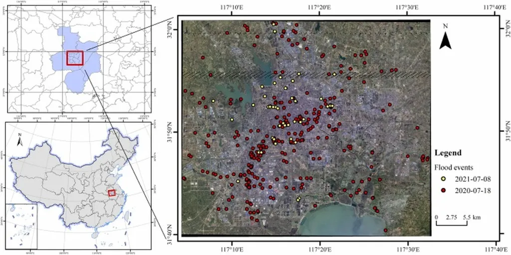
In the heart of China, the city of Hefei is grappling with a challenge that echoes across urban landscapes worldwide: the increasing frequency of extreme rainfall events, a direct consequence of climate change. As cities grow and evolve, so does their vulnerability to flooding, a threat that can cripple infrastructure, disrupt commerce, and endanger lives. Enter Ziyao Xing, a researcher from the National Institute of Natural Hazards, Ministry of Emergency Management of China, who has pioneered a novel approach to map and analyze urban flood susceptibility with unprecedented precision.
Xing’s work, recently published in the *Journal of Hydrology: Regional Studies* (translated as “Regional Hydrology Studies”), combines interpretable machine learning and spatial autocorrelation to create a fine-grained analysis of flood susceptibility. This is not just another flood map; it’s a detailed, localized assessment that considers the unique characteristics of different urban areas.
“Existing methods often treat cities as uniform entities,” Xing explains, “making it challenging to capture the complexity of these localized characteristics.” To address this, Xing and his team developed an ensemble learning model that incorporates terrain, urban construction, and precipitation factors. The result is a nuanced understanding of flood susceptibility that goes beyond the one-size-fits-all approach.
One of the key findings is the significant impact of micro-topography on urban flood susceptibility. By normalizing the Digital Surface Model (DSM) based on micro-watersheds, the team was able to provide an accurate representation of the terrain’s influence on flooding. This is a game-changer for urban planners and flood management strategists, as it allows for targeted interventions that can enhance urban resilience.
Another critical insight is the importance of green spaces in urban flood regulation. The study found that the Normalized Difference Vegetation Index (NDVI), a measure of vegetation health, is the most influential factor in determining flood susceptibility. This underscores the need for cities to invest in and preserve their green spaces, not just for aesthetic or recreational value, but for their crucial role in flood mitigation.
The study also revealed that high flood susceptibility in Hefei follows patterns similar to built-up areas and is influenced by major roads. This is where the Local Interpretable Model-agnostic Explanations (LIME) analysis comes into play. By providing a fine-grained analysis of different regions, LIME helps identify the distinct regional impact factors, such as NDVI, land use, distance to water bodies, and road density. This information is invaluable for developing targeted flood management strategies that can save lives, protect property, and minimize economic disruption.
For the energy sector, the implications are significant. Flooding can disrupt power supply, damage infrastructure, and lead to costly downtime. By understanding and mapping flood susceptibility, energy companies can better prepare for and mitigate these risks. This could mean investing in flood-resistant infrastructure, developing contingency plans, or even influencing urban planning decisions to reduce flood risk in areas critical to energy supply.
Xing’s research is a testament to the power of interpretable machine learning and spatial autocorrelation in enhancing urban resilience. As cities continue to grow and climate change intensifies, the need for such detailed, localized assessments will only increase. This study not only provides valuable insights for flood prevention and urban planning in Hefei but also sets a precedent for other cities worldwide.
In the words of Xing, “This research is not just about mapping flood susceptibility; it’s about empowering cities to build resilience, protect their communities, and plan for a sustainable future.” And in the face of climate change, that is a goal worth pursuing.