In the ever-evolving landscape of agricultural technology, a groundbreaking study led by Feiyu Teng from the School of Information Engineering at China University of Geosciences in Beijing has introduced a novel approach to extracting agricultural parcels from remote sensing images. Published in the journal *Remote Sensing* (which translates to *遥感* in Chinese), this research promises to revolutionize agricultural management and crop production monitoring by addressing longstanding challenges in the field.
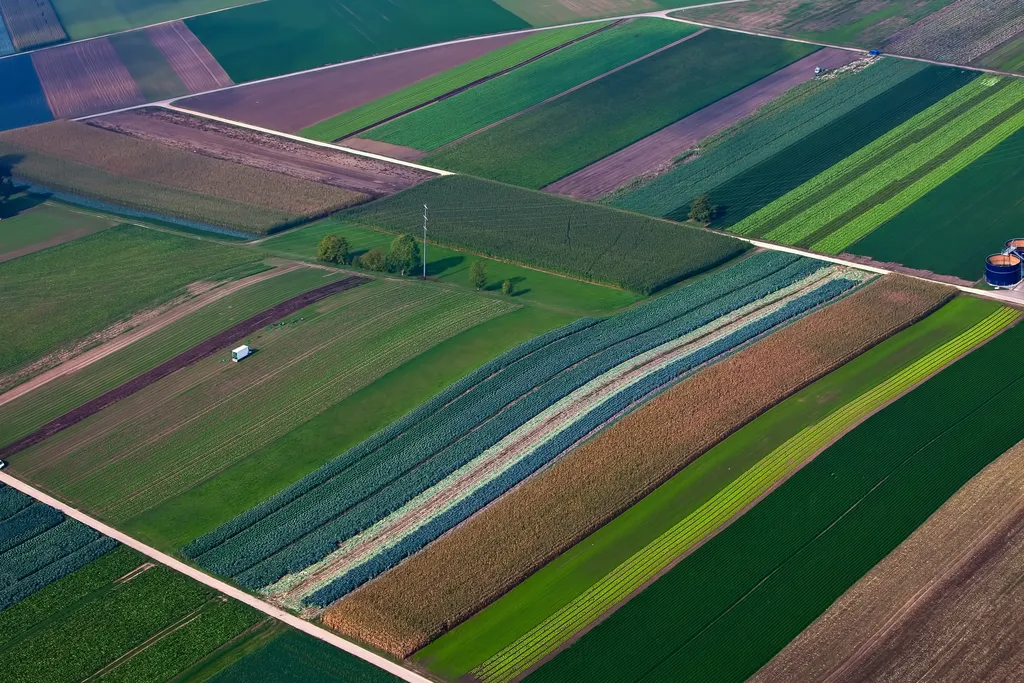
The study focuses on the accurate acquisition of agricultural parcels, a task that has traditionally relied on semantic segmentation through remote sensing images, followed by pixel-level classification and vectorization. However, this method often results in internal cavities, unclosed boundaries, and fuzzy edges, which can hinder the precise extraction of complete agricultural parcels. To overcome these issues, Teng and his team propose a vector contour segmentation network based on a hybrid backbone and multiscale edge feature extraction module, dubbed HEVNet.
HEVNet stands out by predicting the location of contour points, thereby avoiding the problems associated with converting raster data to vector data. “Our approach not only enhances the integrity of agricultural parcel extraction but also significantly improves edge accuracy,” Teng explains. This innovation is crucial for agricultural management, as accurate parcel extraction is essential for monitoring crop production, optimizing resource allocation, and planning agricultural activities.
One of the key components of HEVNet is its hybrid backbone, which combines the strengths of Resnet and Transformer backbone networks. This hybrid approach balances local and global features during feature extraction, ensuring a comprehensive understanding of the image data. Additionally, the multiscale edge feature extraction module enhances edge features at different scales, preventing the loss of edge details during downsampling.
The research team evaluated HEVNet using datasets from Denmark, the Netherlands, iFLYTEK, and Hengyang in China. The results were impressive, with Intersection over Union (IOU) indexes of 67.92%, 81.35%, 78.02%, and 66.35%, respectively. These figures represent a significant improvement over previous models, including the optimal model DBBANet.
The implications of this research are far-reaching. Accurate agricultural parcel extraction can lead to more efficient use of resources, better crop management, and ultimately, increased agricultural productivity. For the energy sector, this technology can aid in the development of bioenergy crops, ensuring that land use is optimized for both food production and energy generation.
As Teng notes, “The potential applications of our model extend beyond agriculture. In the energy sector, precise land use data can inform the development of bioenergy crops, contributing to a more sustainable energy future.” This interdisciplinary approach highlights the broader impact of the research, bridging the gap between agriculture and energy.
The study published in *Remote Sensing* marks a significant step forward in the field of agricultural technology. By addressing the challenges of agricultural parcel extraction, HEVNet paves the way for more accurate and efficient agricultural management. As the world grapples with the challenges of climate change and food security, innovations like HEVNet offer hope for a more sustainable and productive future. The research not only enhances our understanding of agricultural parcel extraction but also sets a new benchmark for future developments in the field.