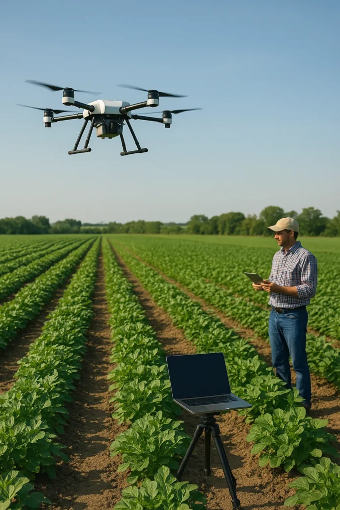
In the ever-evolving landscape of precision agriculture, a groundbreaking study led by Xiaolong Chen from the Faculty of Humanities and Social Sciences at Macao Polytechnic University is set to revolutionize how farmers monitor soil nutrients and apply fertilizers. Published in the journal *Agriculture* (translated from Chinese), the research introduces a dynamic monitoring and precision fertilization decision system that integrates UAV (Unmanned Aerial Vehicle) remote sensing and GIS (Geographic Information System) technologies. This innovation addresses the long-standing limitations of traditional soil nutrient assessment methods, offering a more efficient, accurate, and sustainable approach to farming.
Traditional soil nutrient assessment methods often rely on labor-intensive field sampling and laboratory analysis, which can be time-consuming and costly. Satellite-based approaches, while offering broader coverage, lack the high-resolution spatial and spectral data needed for precise nutrient mapping. Chen’s system, however, combines hyperspectral and multispectral UAV imagery with ground sensor data to achieve unprecedented levels of detail. “By fusing multi-source data, we can capture the nuances of soil nutrient variations across a field, enabling real-time updates and dynamic modeling,” Chen explains. This high-resolution analysis allows farmers to make informed decisions quickly, adapting to the ever-changing conditions of their fields.
The system’s real-time data processing algorithms and time-series dynamic model capture seasonal variations and the influence of different crop growth stages, significantly improving prediction accuracy. In field trials across three distinct agroecological zones, the system reduced fertilizer inputs by 18–27% while increasing crop yields by 4–11%. These results outperform both conventional laboratory-based methods and satellite NDVI (Normalized Difference Vegetation Index) approaches, demonstrating the system’s potential to optimize resource use and enhance productivity.
One of the most compelling aspects of this research is its intelligent fertilization decision model. By analyzing real-time soil conditions, crop demands, and climate factors, the model generates tailored fertilization plans. “This continuous learning capability enhances the system’s precision over time, making it a valuable tool for farmers seeking to maximize yields while minimizing environmental impact,” Chen notes. The integration of GIS-based visualization tools further enhances the system’s utility, providing intuitive spatial representations of nutrient distributions and interactive functionalities for detailed insights.
The commercial implications for the energy sector are substantial. As the global population grows and the demand for food increases, the need for sustainable and efficient agricultural practices becomes ever more critical. By reducing fertilizer use and increasing crop yields, this system not only boosts farm productivity but also contributes to environmental sustainability. “This technology has the potential to transform precision agriculture, making it more accessible and effective for farmers worldwide,” Chen says. The system’s scalability and adaptability offer a framework for sustainable farming practices, aligning with the growing emphasis on environmental stewardship and resource efficiency.
Looking ahead, this research paves the way for future developments in precision agriculture. The integration of UAV remote sensing, dynamic modeling, and machine learning distinguishes this work from conventional static systems, offering a scalable and adaptive framework. As technology continues to advance, the potential for further innovation in this field is immense. Chen’s work serves as a testament to the power of interdisciplinary collaboration and the transformative potential of cutting-edge technologies in agriculture.
In a world where sustainability and efficiency are paramount, this research offers a glimpse into the future of farming. By harnessing the power of UAV remote sensing and GIS technologies, farmers can achieve unprecedented levels of precision and productivity, ensuring a more sustainable and food-secure future for all.