In the heart of China’s Sichuan Basin, a region bustling with natural gas extraction and intensive agriculture, a groundbreaking study has shed new light on the spatiotemporal variations of atmospheric methane (CH4). Led by Tengnan Wang from the State Key Laboratory of Deep Earth Processes and Resources at the Chinese Academy of Sciences, the research leverages multi-source satellite data to provide a comprehensive overview of methane concentrations from 2003 to 2021.
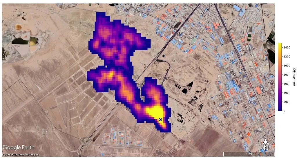
The Sichuan Basin, a significant player in China’s energy sector, has long been under the microscope for its environmental impact. This study, published in the journal ‘Remote Sensing’ (translated from Chinese as ‘遥感’), integrates data from multiple satellites—SCIAMACHY, GOSAT, and Sentinel-5P—to construct a long-term dataset of column-averaged dry-air mole fraction of methane (XCH4). The results reveal a stark reality: the basin’s methane levels are approximately 20 parts per billion (ppb) higher than the national average, with an alarming increasing trend in rates, from around 2.27 ppb to 10.44 ppb per year.
“Our findings indicate a strong correlation and consistency between ground station and satellite observations,” Wang explains. “This consistency is crucial for accurate monitoring and management of methane emissions.” The study also highlights clear seasonal variations, with higher concentrations in summer and autumn, and lower levels in winter and spring. Geographically, the distribution is clustered, pointing to specific hotspots within the basin.
The implications for the energy sector are profound. Methane, a potent greenhouse gas, is a byproduct of both agricultural activities and natural gas extraction. Understanding its distribution and trends is essential for effective carbon emission management. “Agricultural activities and natural gas extraction contribute significantly to atmospheric methane concentrations in the study area,” Wang notes. “These factors must be considered in carbon emission management strategies.”
This research provides a robust framework for investigating methane concentrations at a regional scale, considering both natural and human influences. By utilizing multi-source satellite remote sensing data, it offers a scalable model that could be applied to other regions with similar environmental and industrial profiles.
The study’s findings could shape future developments in the energy sector, particularly in natural gas exploitation and agricultural practices. As the world grapples with the challenges of climate change, such research is invaluable for devising strategies that balance economic growth with environmental sustainability. The integration of satellite data provides a powerful tool for monitoring and managing methane emissions, paving the way for more informed decision-making in the energy industry.
In an era where environmental consciousness is paramount, this research underscores the importance of leveraging technology to understand and mitigate the impacts of human activities on the atmosphere. As Wang and his team continue to delve into the complexities of methane distribution, their work serves as a beacon for future studies in environmental science and technology.