In the heart of Beijing, a team of researchers led by Zhe Yang from the State Key Laboratory of Remote Sensing and Digital Earth at Beijing Normal University has developed a groundbreaking framework that could revolutionize urban wetland mapping. Their work, published in the journal *Ecological Indicators* (translated from Chinese as “生态指标”), introduces an automated system called Fusion Knowledge Rules and Spectral Matching (FKRSM) that significantly reduces the time and effort required to generate and migrate training samples for urban wetland mapping.
Urban wetlands are crucial ecosystems that provide numerous benefits, including water purification, flood control, and biodiversity support. However, accurately mapping these wetlands in complex urban environments has been a persistent challenge due to the high cost and labor-intensive nature of sample production. Yang and his team aimed to address this issue by leveraging the power of Google Earth Engine (GEE) and advanced spectral analysis techniques.
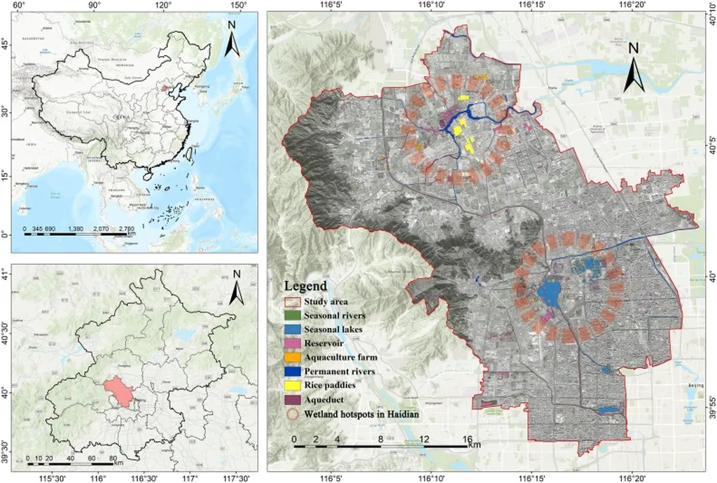
The FKRSM framework utilizes dense Sentinel-2 time series data and multi-source classification products to extract key dynamics of urban wetlands, such as vegetation-hydrology interactions, inundation frequency patterns, and geometric attributes. By combining index-threshold reclassification with morphological purification, the system can delineate specific sample generation zones and produce corresponding training samples automatically.
One of the most innovative aspects of FKRSM is its dual-constraint spectral matching method, which employs Spectral Angle Distance (SAD) and Euclidean Distance (ED) to reduce manual effort in determining unchanged sample thresholds. This allows for dynamic migration of urban wetland training samples across different years, ensuring consistent and accurate mapping over time.
The researchers tested FKRSM across 43 Ramsar Wetland Cities (RWCs), achieving an impressive sampling accuracy of 97.72% for the 2022 reference year. Migrated samples across 2016, 2018, 2020, and 2024 maintained an average accuracy of 92.53%. Compared to previous methods, FKRSM demonstrated a 216.85% improvement in performance, measured by production time and classification accuracy, in China’s first batch of 6 RWCs.
“This framework not only enhances the efficiency of urban wetland mapping but also supports the re-accreditation of existing Ramsar Wetland Cities and the accreditation of new cities,” said Yang. “It offers a scalable solution for fine-scale urban wetland mapping, which is crucial for environmental management and conservation efforts.”
The implications of this research extend beyond environmental science. For the energy sector, accurate urban wetland mapping can inform the development of sustainable energy projects, such as hydroelectric power plants and bioenergy facilities, by identifying suitable locations and assessing potential environmental impacts. Additionally, the framework’s ability to reduce costs and improve efficiency can make wetland conservation efforts more economically viable, fostering collaboration between environmental and energy sectors.
As the world continues to urbanize, the need for effective urban wetland management will only grow. The FKRSM framework developed by Yang and his team represents a significant step forward in this field, offering a powerful tool for researchers, policymakers, and industry professionals alike. With its demonstrated spatiotemporal generalizability, FKRSM has the potential to shape the future of urban wetland mapping and conservation efforts worldwide.