In the rapidly evolving world of precision agriculture, a groundbreaking study led by Jian Li from the College of Information Technology at Jilin Agricultural University in Changchun, China, is set to revolutionize the way unmanned aerial vehicles (UAVs) navigate complex agricultural landscapes. The research, published in *Frontiers in Plant Science* (translated as “植物科学前沿”), introduces an advanced path planning algorithm that promises to enhance the efficiency and effectiveness of agricultural UAV operations.
Traditional path planning algorithms have long grappled with issues such as local optimum traps and low monitoring efficiency, which can hinder the performance of UAVs in intricate agricultural environments. These challenges have made it difficult to meet the operational demands of modern precision agriculture, where efficiency and accuracy are paramount. Recognizing this gap, Li and his team set out to develop an intelligent path planning algorithm that could overcome these limitations.
The study proposes an improved Informed-RRT* (Rapidly-exploring Random Tree*) path planning algorithm, guided by a domain-partitioned A* algorithm. This innovative approach employs a multi-level decomposition strategy, intelligently dividing complex paths into a sequence of key sub-segments. Additionally, an adaptive node density allocation mechanism dynamically responds to changes in path complexity, ensuring optimal performance even in the most challenging environments.
One of the standout features of this algorithm is its dual-layer optimization framework, which combines elliptical heuristic sampling with dynamic weight adjustment. This combination allows the algorithm to achieve superior path smoothness and feasibility, while also ensuring a more balanced distribution of search nodes. As Li explains, “Our algorithm not only reduces computation time significantly but also shortens path length, making it a highly efficient tool for agricultural UAV operations.”
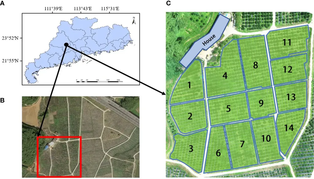
To evaluate the algorithm’s performance, the researchers constructed complex maps with varying obstacle densities. The results were impressive: the proposed algorithm reduced computation time by 56.3% to 92.5% and shortened path length by 0.42% to 8.5% compared to traditional RRT* and its improved variants. These findings highlight the algorithm’s potential to enhance the efficiency and effectiveness of UAV operations in complex agricultural environments.
The implications of this research are far-reaching. As precision agriculture continues to evolve, the need for intelligent, efficient, and adaptable path planning algorithms will only grow. The A*-MSRRT* (A*-Guided Multi-stage Bidirectional Informed-RRT*) algorithm developed by Li and his team represents a significant step forward in this field, offering a powerful tool for optimizing UAV operations in agriculture.
Looking ahead, this research could pave the way for further advancements in the field of precision agriculture. As Li notes, “Our algorithm has strong potential for application in complex agricultural environments, and we believe it will play a crucial role in shaping the future of precision agriculture.” With its ability to enhance the efficiency and effectiveness of UAV operations, the A*-MSRRT* algorithm is poised to make a significant impact on the agricultural sector, ultimately contributing to more sustainable and productive farming practices.
In conclusion, the research led by Jian Li and his team at Jilin Agricultural University represents a major advancement in the field of precision agriculture. By addressing the limitations of traditional path planning algorithms, the A*-MSRRT* algorithm offers a powerful and adaptable solution for optimizing UAV operations in complex agricultural environments. As the agricultural sector continues to embrace the benefits of precision agriculture, this research will undoubtedly play a pivotal role in shaping the future of the industry.

