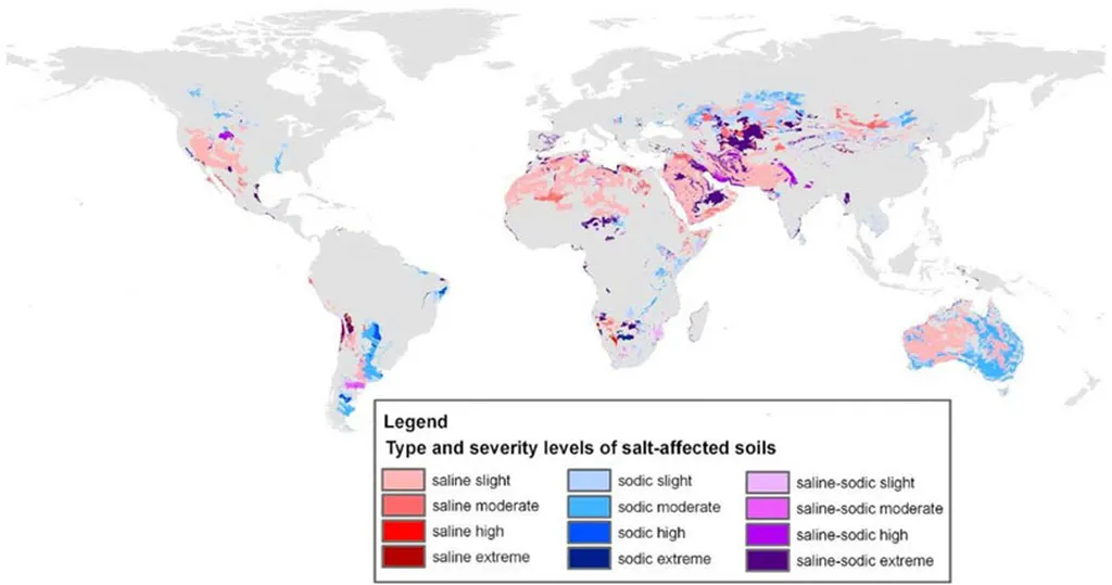
In the heart of Texas, researchers are tackling a pressing issue for global agriculture: soil salinity. Deen Dayal, a scientist at Texas A&M AgriLife Research, has developed a novel approach to predict soil salinity using aerial multispectral data, potentially revolutionizing how farmers and energy sector stakeholders manage this critical resource.
Soil salinity is a significant concern, particularly in arid and semi-arid regions where saline water irrigation is often used to meet crop water demands. Traditional methods of estimating soil salinity have often overlooked spatial autocorrelation, leading to potential inaccuracies in model performance. Dayal’s study, published in the journal *Smart Agricultural Technology* (translated from Chinese as “智能农业技术”), introduces a spatially aware Bayesian deep learning framework that accounts for this spatial autocorrelation, offering a more reliable prediction model.
The research leverages aerial multispectral data and in situ soil observations to establish relationships between spectral features and soil salinity. Dayal and his team developed eight Bayesian Neural Network (BNN) models, four using unfiltered multispectral features and four using spatially filtered covariates processed via the Moran Eigenvector Filtering (MEF) technique. The results were striking. Incorporating the red-edge (REG) band improved model efficiency by over 10% during both training and testing. Using REG-derived spectral indices led to even greater improvements, with up to a 20.35% increase in model efficiency during testing.
“One of the most significant findings was the substantial improvement in model performance when we used decomposed covariates derived through MEF,” Dayal explained. “This approach resulted in a 94.61% increase in model efficiency and a 32.89% reduction in estimation error.” The best-performing model incorporated spatially filtered spectral indices, including those derived from the REG band.
The implications of this research extend beyond agriculture. For the energy sector, particularly in regions where bioenergy crops are irrigated with saline water, accurate soil salinity prediction can inform water management strategies and optimize crop yields. “Understanding the spatial structure of soil salinity is crucial for making informed decisions,” Dayal noted. “Our study highlights the importance of accounting for spatial autocorrelation to ensure the accuracy and interpretability of model features.”
This research not only advances the field of agricultural technology but also underscores the importance of integrating spatial data into predictive models. As Dayal’s work demonstrates, failure to account for spatial autocorrelation can lead to misleading conclusions and compromise the reliability of predictions. By embracing these advanced techniques, the agricultural and energy sectors can move towards more sustainable and efficient practices.
The study’s findings pave the way for future developments in precision agriculture, where data-driven insights can guide farmers and energy producers in managing soil health and optimizing resource use. As the world grapples with the challenges of climate change and water scarcity, innovations like Dayal’s offer hope for a more resilient and sustainable future.

