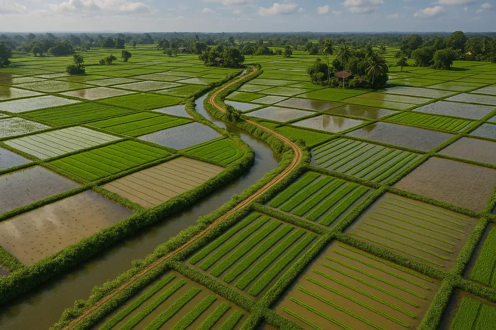
In the lush, verdant landscapes of Sri Lanka, where rice paddies paint a patchwork of green and gold, a groundbreaking study is set to revolutionize how we monitor and understand one of the world’s most vital crops. Led by Mutlu Özdoğan from the University of Wisconsin-Madison, this research leverages optical satellite data to map rice fields and estimate yields with unprecedented accuracy, offering a beacon of hope for food security and agricultural policy in developing nations.
The challenge of monitoring rice cultivation in Sri Lanka is immense. Frequent cloud cover and the fragmented nature of smallholder farms have long obscured the ability to gather reliable data. Traditional surveys fall short, leaving policymakers and farmers in the dark about crucial information. Enter Özdoğan’s innovative approach, which combines phenologically tuned image classification with random forest regression models to create detailed, field-scale maps of rice-planted areas and yields.
“Our method highlights rice presence by observing water occurrence during transplanting and vegetation activity during subsequent crop growth,” Özdoğan explains. This phenology-driven approach ensures long-term consistency, a significant advantage over purely statistical machine learning models. By incorporating satellite-derived chlorophyll indices and environmental variables, the team achieved map accuracies ranging from 70% to over 90% and yield estimates with less than 20% error.
The implications of this research are profound. For the first time, policymakers and farmers have access to highly granular data spanning two decades (2000–2022). This information is not just a tool for monitoring; it’s a compass for navigating the complexities of food security and agricultural policy. “These results show a strong correlation with government statistics,” Özdoğan notes, underscoring the reliability of the method.
The commercial impacts for the energy sector are equally compelling. Accurate, timely data on rice cultivation can inform energy policies, particularly in regions where agriculture and energy are intertwined. For instance, understanding the spatial and temporal dynamics of rice farming can optimize irrigation schedules, reducing water usage and energy consumption. This synergy between agriculture and energy can drive sustainable practices, benefiting both farmers and the environment.
Published in the journal ‘Remote Sensing’ (translated to English as ‘Distant Observation’), this study is a testament to the power of remote sensing technology. It opens doors to future developments, where advanced algorithms and satellite data could transform how we monitor and manage crops worldwide. As Özdoğan’s work demonstrates, the future of agriculture lies in the skies, where satellites and innovative minds are paving the way for a more secure and sustainable world.
In the ever-evolving landscape of agritech, this research stands as a beacon of innovation, offering a glimpse into a future where data-driven decisions shape the destiny of food security and agricultural policy. The journey has just begun, and the possibilities are as vast as the skies above Sri Lanka’s rice paddies.