In the heart of Southwest China, where rice paddies paint a patchwork quilt across the landscape, a significant breakthrough in agricultural technology is unfolding. Researchers, led by Ziyi Tang from the College of Resources at Sichuan Agricultural University, have developed an innovative method to enhance paddy rice mapping using deep learning and remote sensing. This advancement promises to revolutionize agricultural monitoring, with profound implications for food security and market stability.
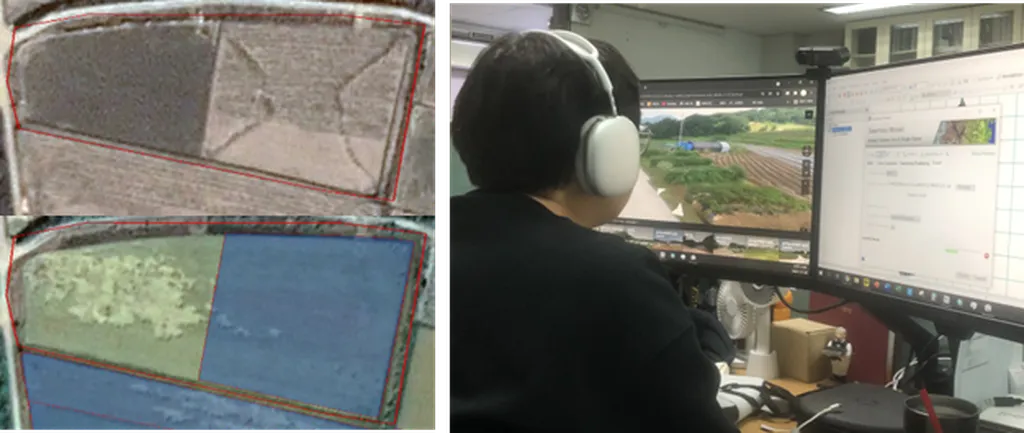
The challenge in this region has long been the fragmented nature of rice paddies and the difficulty in collecting field samples, which has hindered the application of deep learning technologies. Tang and his team tackled this issue head-on by proposing an automatic sample augmentation method based on the Segment Anything Model (SAM) and phenological features. “Our goal was to overcome the sample scarcity that has been a bottleneck in deep learning applications for paddy rice mapping,” Tang explained. By leveraging multidimensional phenological data from Sentinel-2, Landsat 8/9, and MODIS imagery, the team constructed a robust dataset that forms the backbone of their method.
The researchers utilized SAM’s “point prompt” mode and temporal similarity measures based on edit distance for real penalty (ERP) to automatically augment high-quality sample data from limited field-collected samples. This process increased paddy rice samples by 25-fold and non-paddy rice samples by 95-fold, ensuring quality through strict multidimensional ERP distance controls. The results were striking. The composite sample set, which combined field-collected and SAM-augmented samples, showed a significant improvement in mapping accuracy. Specifically, it achieved a 17% improvement in Matthews correlation coefficient (MCC) and a 16% improvement in mean intersection over union (mIoU) compared to the field-collected sample set alone.
To adapt to the point sample inputs, the team developed a novel one-dimensional deep learning model called MBiTGA. This model consistently outperformed five baseline models across all evaluation metrics, achieving superior results for mIoU (0.8806), overall accuracy (0.9365), MCC (0.8749), F1 score (0.9365), Precision (0.9370), and Recall (0.9379). “The MBiTGA model’s performance is a testament to the effectiveness of our approach,” Tang noted. “It demonstrates the potential of deep learning in fine-scale agricultural mapping, even in challenging environments.”
The implications of this research extend beyond the borders of Southwest China. Accurate and efficient paddy rice mapping is crucial for agricultural monitoring, ensuring food security, and maintaining market stability. As the world grapples with the impacts of climate change and population growth, such technological advancements become increasingly vital. “This method provides a scalable solution that can be adapted to other regions and crops,” Tang added. “It’s a step towards more resilient and sustainable agricultural practices.”
Published in the IEEE Journal of Selected Topics in Applied Earth Observations and Remote Sensing, this study offers a glimpse into the future of agricultural technology. The integration of deep learning and remote sensing data holds the promise of transforming how we monitor and manage our agricultural landscapes. As researchers continue to refine these methods, the potential for enhancing food security and market stability becomes ever more tangible. This breakthrough not only addresses current challenges but also paves the way for future innovations in the field.