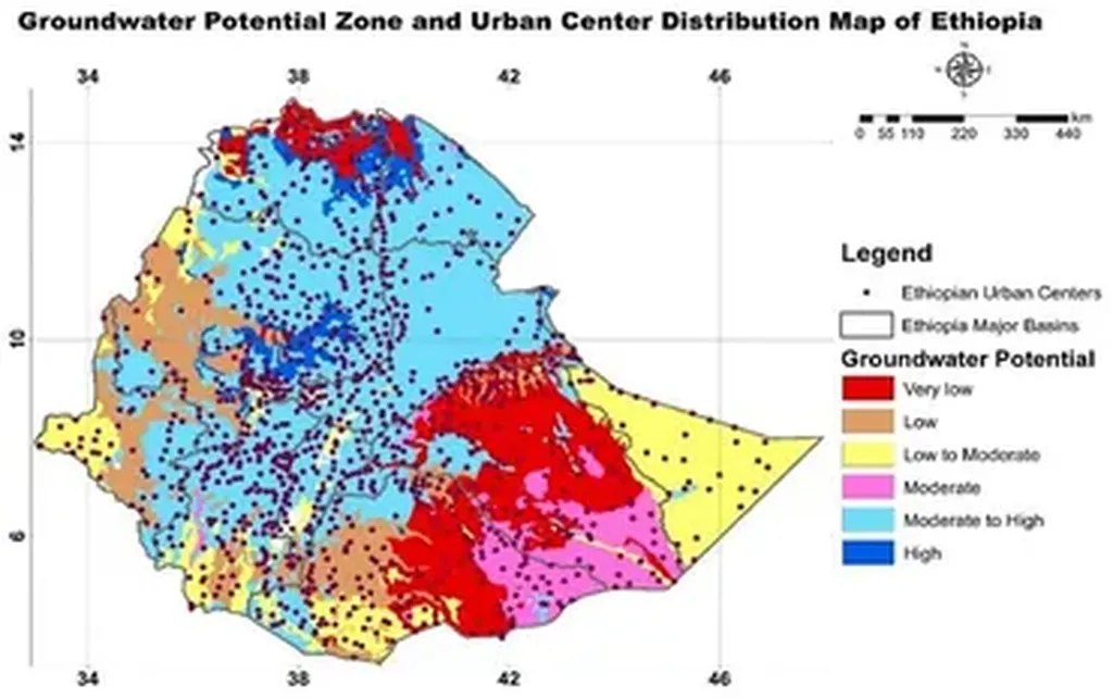
In the heart of Ethiopia’s Omo Basin, a critical tool for sustainable water resource management is being refined, with significant implications for agriculture and energy sectors. A recent study led by Yonas Oyda from the Department of Geology at Arba Minch University has introduced an advanced method for groundwater vulnerability mapping, integrating the DRASTIC model with an entropy-weighted modification in a GIS environment. This research, published in the journal *Scientific African* (translated to English as “African Science”), offers a promising approach to protect vital water resources in regions where agriculture is the backbone of the economy.
Groundwater vulnerability mapping is essential for identifying areas at risk of contamination, particularly in regions where agriculture is the primary livelihood. Contamination in these areas can have devastating effects on both the environment and the economy, as pollutants can seep into the groundwater, making it unsuitable for irrigation and consumption. “Groundwater is highly susceptible to contamination due to the slow natural attenuation of pollutants and the limited feasibility of artificial remediation,” explains Oyda. “This makes it crucial to assess and map vulnerability accurately.”
The study focused on the Maze–Zenti catchment, a key area within the Omo Basin. By utilizing four overlay index models—DRASTIC, Modified DRASTIC, Entropy-DRASTIC, and Entropy-Modified DRASTIC—the research team aimed to improve the accuracy of vulnerability mapping. The Shannon Entropy technique was integrated to optimize parameter weighting, enhancing the models’ predictive capabilities.
The results were compelling. The DRASTIC and Modified DRASTIC models classified the study area into five vulnerability zones: very low, low, moderate, high, and very high. In contrast, the entropy-weighted models grouped the area into four classes: very low, low, moderate, and high groundwater vulnerability to pollution. Notably, the Entropy-modified DRASTIC model demonstrated a strong correlation with observed nitrate concentrations, indicating its superior predictive capability.
“This study highlights the importance of integrating advanced techniques like entropy weighting to improve the accuracy of groundwater vulnerability assessments,” says Oyda. “The Entropy-modified DRASTIC model not only provides a more reliable assessment but also supports informed decision-making for sustainable groundwater protection and land use planning.”
The commercial impacts of this research are significant, particularly for the energy sector. Accurate groundwater vulnerability mapping can help energy companies identify and mitigate risks associated with water contamination, ensuring a stable water supply for their operations. This is crucial for industries that rely on water for cooling, processing, and other essential functions.
Moreover, the integration of land use/land cover (LULC) data further refined the delineation of vulnerable zones, enhancing the overall performance of the models. This approach can be applied to other regions, providing a robust framework for groundwater vulnerability assessment and management.
As the world grapples with the challenges of climate change and increasing water scarcity, innovative solutions like those presented in this study are more important than ever. By leveraging advanced technologies and techniques, we can better protect our vital water resources and ensure sustainable development for future generations.
This research not only advances our understanding of groundwater vulnerability but also paves the way for more effective water resource management strategies. As Oyda and his team continue to refine their models, the potential for widespread application and impact grows, offering hope for a more sustainable future.

