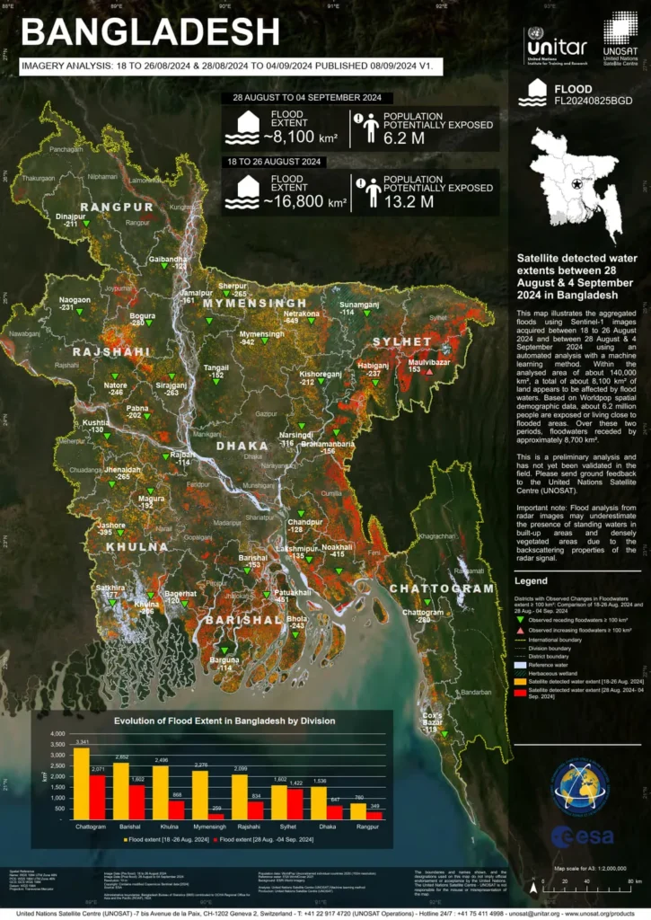
In the wake of the devastating floods that swept through Bangladesh’s Sylhet division in June 2024, a team of researchers led by Imran Khan from the Institute of Water Modelling (IWM) in Dhaka has published a groundbreaking study in the journal *Natural Hazards Research*. The study, titled “Earth observation data-based assessment of the impacts of June 2024 flooding in the Sylhet division of Bangladesh,” offers a detailed analysis of the flood’s extent, its impact on the population, infrastructure, and agriculture, and provides valuable insights for future disaster management and preparedness.
The Sylhet division, a densely populated region in northeastern Bangladesh, faced severe flooding in two phases. The first phase was triggered by Cyclone Remal, which made landfall on May 26, 2024, and the second phase occurred by mid-June. The study utilized advanced Earth observation data from Sentinel-1 and Sentinel-2 satellites, along with population and building data from WorldPop and the Bangladesh Bureau of Statistics, to assess the flood’s impact.
The findings are striking. As of June 19, 2024, approximately 66% of the Sylhet division was inundated. The flooding affected around 6.25 million people and exposed about 607,000 buildings to potential damage. “The scale of the inundation was immense,” noted Imran Khan, the lead author of the study. “Major cities like Sylhet and Sunamganj were severely affected, with large populations displaced and infrastructure compromised.”
The study also delved into the agricultural impacts, revealing that about 93% of crops planted during the Boro season of 2024 had already been harvested before the flooding. However, approximately 14,700 hectares of remaining cropland suffered damage. “The timing of the flood, occurring at the onset of the monsoon season rather than the pre-monsoon period, mitigated some of the potential agricultural damage,” explained Khan. “Nevertheless, the economic and social impacts on the region were significant.”
The commercial implications of this research are profound, particularly for the energy sector. Flooding can disrupt energy infrastructure, leading to power outages and economic losses. Understanding the extent and impact of such events can help energy companies develop more resilient infrastructure and better preparedness plans. “This research underscores the importance of integrating Earth observation data into disaster management strategies,” said Khan. “By leveraging advanced remote sensing techniques, we can enhance our ability to assess and respond to natural disasters, ultimately protecting lives and livelihoods.”
The study published in *Natural Hazards Research* (translated to English as *Natural Hazards Research*) highlights the critical role of Earth observation data in disaster impact assessment. It provides a robust framework for future research and practical applications in disaster management. As climate change continues to exacerbate the frequency and intensity of natural disasters, such studies become increasingly vital. They offer a roadmap for building more resilient communities and economies, ensuring that we are better prepared to face the challenges of an uncertain future.

