In the ever-evolving landscape of precision agriculture, a groundbreaking study led by Xiaokai Chen from the College of Natural Resources and Environment at Northwest A&F University in China is set to revolutionize how we monitor and manage crop nutrition. The research, published in the IEEE Journal of Selected Topics in Applied Earth Observations and Remote Sensing (translated as “IEEE Journal of Selected Topics in Applied Earth Observations and Remote Sensing”), introduces a novel approach to mapping winter wheat plant nitrogen concentration (PNC) using a combination of unmanned aerial vehicles (UAVs) and satellite remote sensing.
Accurate and real-time prediction of PNC is crucial for assessing the nitrogen status of winter wheat, a staple crop that feeds millions worldwide. Traditional satellite remote sensing, while effective for large-scale monitoring, often suffers from coarse spatial resolution, leading to scale mismatches with field sampling. This is where UAVs come into play, bridging the gap between satellite observations and ground measurements.
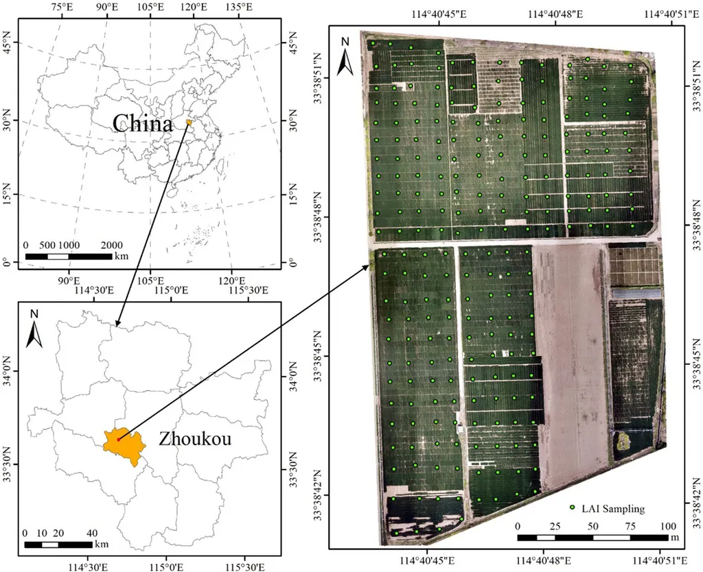
Chen and his team employed a multi-step approach to map regional-scale winter wheat PNC. First, they used UAV-based vegetation indices (VIs) with machine learning algorithms to predict PNC at the field scale. “The UAV data provided high-resolution images that allowed us to capture the variability within individual fields,” Chen explained. Next, the UAV data were aggregated to match satellite resolution, producing field-scale PNC maps. These maps were then used as regional-scale samples, combined with satellite VIs, to develop PNC estimation models.
The results were impressive. At the regional scale, support vector regression with Sentinel-2 VIs performed best, achieving an R-squared value of 0.95, a root mean square error (RMSE) of 0.09%, and a residual predictive deviation (RPD) of 4.70. Validation with ground samples and UAV-scale PNC maps confirmed the reliability of the cross-scale models, with R-squared values ranging from 0.75 to 0.96, RMSE values from 0.09% to 0.29%, and RPD values from 1.93 to 4.85.
Among the two satellite sensors evaluated, Sentinel-2 outperformed PlanetScope in PNC estimation, likely due to its more optimal red-edge spectral configuration. “The red-edge bands in Sentinel-2 are particularly sensitive to changes in vegetation health and nitrogen content,” Chen noted.
The implications of this research are significant for the agricultural sector and beyond. By providing a reliable tool for large-scale crop nitrogen monitoring, this approach can help farmers optimize fertilizer use, reduce environmental impact, and improve crop yields. For the energy sector, which relies heavily on agricultural products for biofuels, this technology can ensure a steady and sustainable supply of feedstock.
Looking ahead, this study highlights the effectiveness of UAV-satellite cross-scale remote sensing for regional-scale PNC mapping. As Chen puts it, “This approach not only enhances our understanding of crop nutrition dynamics but also paves the way for more precise and sustainable agricultural practices.” The integration of UAV and satellite data, coupled with advanced machine learning techniques, is set to shape the future of precision agriculture, offering new opportunities for innovation and growth in the field.
In an era where technology and agriculture intersect, this research stands as a testament to the power of innovation in addressing real-world challenges. As we move forward, the insights gained from this study will undoubtedly inspire further developments, driving the agricultural sector towards a more efficient and sustainable future.