In the heart of Hangzhou, a city renowned for its harmonious blend of urban life and lush greenery, a groundbreaking study is reshaping how we perceive and manage urban green spaces. Led by Baiyu Dong from the School of Spatial Planning and Design at Hangzhou City University, the research published in the IEEE Journal of Selected Topics in Applied Earth Observations and Remote Sensing, is pioneering a new approach to high-resolution satellite imagery analysis. This method promises to revolutionize urban ecosystem management and sustainable city planning, with significant implications for the energy sector.
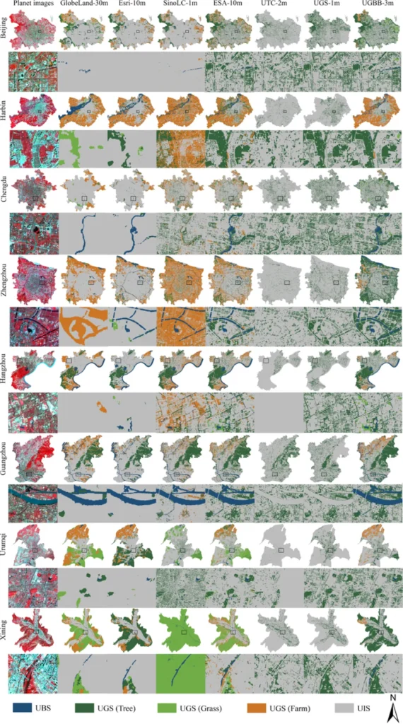
The study addresses a critical challenge in urban planning: the accurate and timely interpretation of high-resolution images of urban green spaces (UGS). Traditional object-based image analysis (OBIA) has been effective in capturing the structural characteristics of urban vegetation, but its effectiveness diminishes as spatial resolution increases due to amplified spatial heterogeneity within segmented objects. Enter deep learning, a powerful tool that bridges the gap between complex image patterns and their semantic labels.
Dong and his team employed a modified U-Net architecture with ResNet50 backbone and attention mechanisms, synergizing deep feature extraction with OBIA principles. The process involved three main steps: extracting UGSs using a deep learning model to derive semantic features, multiscale segmentation of the green space, and classification of the green space units using a machine learning classifier with fused deep spectral features.
The results are impressive. “With the combination of deep learning and object-based classification, we can now discriminate different UGS types in Hangzhou at a community level,” Dong explains. This methodological advancement not only establishes a new paradigm for high-precision UGS mapping but also provides actionable insights for urban ecological studies and landscape planning.
The implications for the energy sector are profound. Accurate mapping of urban green spaces can inform the placement of renewable energy infrastructure, such as solar panels and wind turbines, ensuring they are situated in areas that maximize energy output while minimizing environmental impact. Additionally, understanding the distribution and health of urban green spaces can aid in the development of energy-efficient urban designs that reduce the urban heat island effect, lowering energy consumption for cooling.
This research is a testament to the power of integrating advanced technologies like deep learning with traditional methodologies to solve complex urban challenges. As cities around the world grapple with the effects of climate change and the need for sustainable development, the insights gained from this study could shape future urban planning and energy strategies.
In the words of Dong, “This is just the beginning. The potential applications of this methodology are vast, and we are excited to see how it will influence the future of urban ecology and energy efficiency.” As we look ahead, the fusion of deep learning and OBIA holds the promise of smarter, greener, and more sustainable cities.