In a significant move demonstrating the global scalability of “India-first” innovations, Google has announced the expansion of its foundational AI models for agriculture to the wider Asia-Pacific region. The Agricultural Landscape Understanding (ALU) and Agricultural Monitoring and Event Detection (AMED) APIs, which have been empowering an ecosystem of startups and government bodies in India, are now being made available to trusted testers in Malaysia, Indonesia, Vietnam, and Japan.
These freely available models leverage remote sensing and machine learning to provide hyperlocal insights, aiming to solve some of the most deep-seated challenges in agriculture. To understand the technology, its impact, and the vision behind this expansion, I sat down with Alok Talekar, Lead for Agriculture and Sustainability Research at Google DeepMind, and Avneet Singh, a Product Manager in Google’s Partner Innovation team.
Agriculture, particularly in a country as vast as India, is not a monolith. It’s a complex, fragmented ecosystem where solutions that work in one state might be entirely ineffective in another. This is the core problem Google set out to address. When asked about the key challenge his team identified, Alok Talekar was clear. “Largely, everybody wants to do the right thing, but agriculture is very diverse in the country,” he explained. “And they just don’t have the right tools and access to information.”
Historically, agricultural data has been aggregated at a high level – district, block, or perhaps village. According to Avneet Singh, this isn’t granular enough. “The right intervention, the right advisory is kind of needed at an individual field level,” Singh noted. “That’s the gap that we’re hoping to address.” Without field-level data, decision-making becomes blunt and inefficient. As Talekar elaborated, “There isn’t a single silver bullet. The answer that’s true in, say, Kerala may not be true in Bihar, may not be true in Vietnam. So there have to be different local decisions that need to be adopted everywhere. You need a core underpinning of data that helps you make data-driven decisions.”
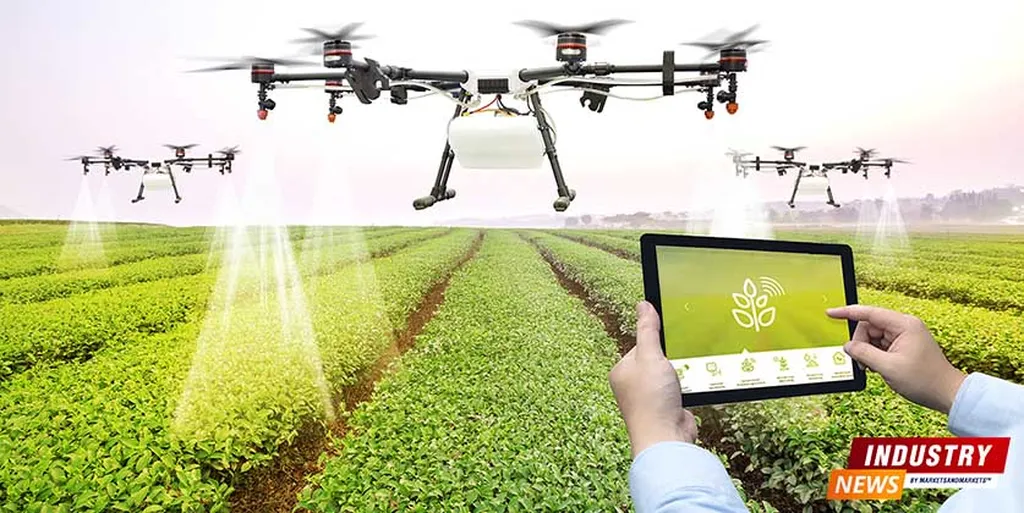
Instead of building a single application, Google has developed two foundational models that act as a base layer for an entire ecosystem to build upon. Agricultural Landscape Understanding (ALU): Launched in India in October 2024, this is the first layer. As Avneet Singh described, “ALU is our effort at segmenting the agricultural landscape into multiple classes.” Using satellite imagery, it identifies and draws boundaries for individual fields, water bodies, and vegetation, essentially creating a detailed digital map of the agricultural landscape. Agricultural Monitoring and Event Detection (AMED): Building on ALU, the AMED API, released in July 2025, provides dynamic insights. “This is where we actually start looking at what is happening at an individual field,” Singh said. AMED can identify the current crop being grown, calculate the acreage of the field, and track key events like sowing and harvesting dates. Crucially, its data is refreshed every 15 days, allowing for near real-time monitoring. Together, these models provide a powerful, unbiased dataset that was previously unavailable. “We are unlocking a flood of data that was previously not available,” Talekar stated. “This launch announcement is not the end of the journey, but it’s the start of a journey where we expect partners will start using this data.”
Powering these models is a massive trove of geospatial data. “Primarily, all of these models depend on earth observation data, largely coming from satellite imagery, either public satellite imagery or licensed satellite imagery that Google has,” Talekar clarified. He explained that Google’s decades of investment in geospatial technologies like Google Maps provide a unique advantage. This unlocks capabilities that were once the exclusive domain of massive agricultural corporations for smallholder farmers. But with AI, accuracy and bias are always key concerns. Talekar was candid about the challenges. “Any model that’s working at such massive scales… is not going to be perfectly accurate everywhere. Anybody can go and find some field that we get wrong,” he admitted. “But what is the statistical accuracy you need at scale that enables this to be useful? That is a question that needs to be answered for each use case specifically.” To ensure the models are useful, Google employs a multi-pronged validation strategy, including standard machine learning checks, comparison with aggregate government census data, and independent spot checks by third parties like the startup TerraStac and the Government of Telangana.
So, how does this technology benefit a farmer who has little knowledge of APIs or AI? The impact is delivered through the ecosystem partners who use Google’s models. Avneet Singh provided a practical example: an AgriTech company aiming to help farmers maximise crop yield. “They can at scale