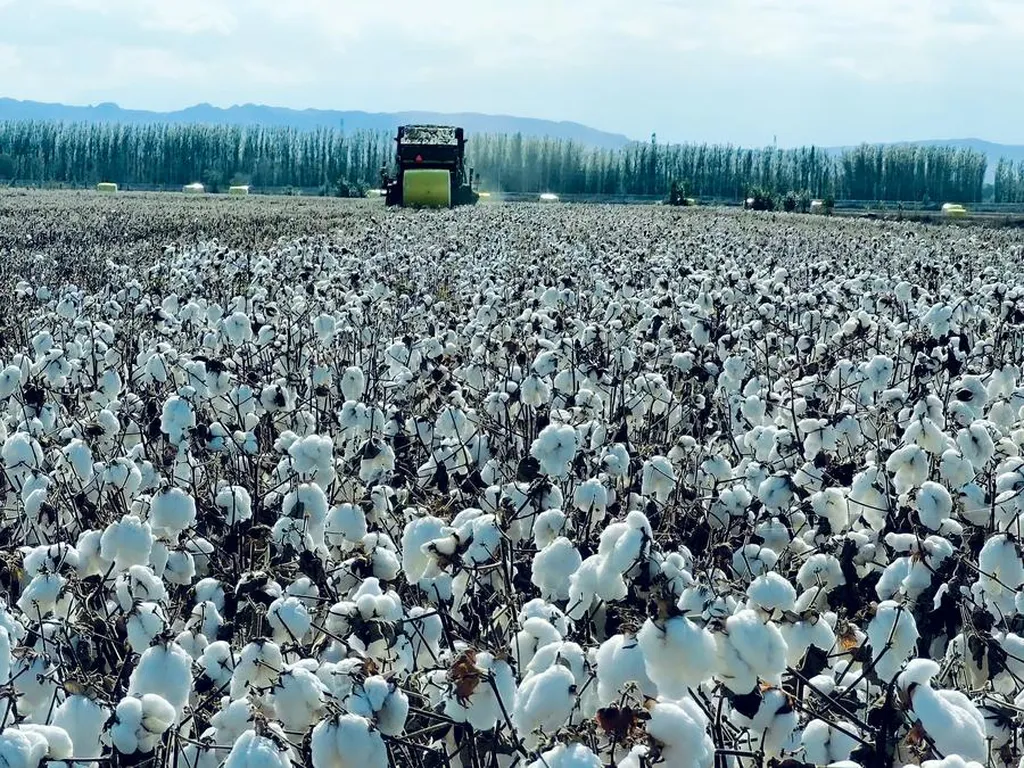
In the heart of Xinjiang, China, a groundbreaking study is set to revolutionize cotton farming by addressing a longstanding challenge in satellite remote sensing: the trade-off between spatial resolution and coverage range. The research, published in *Industrial Crops and Products*, introduces a novel approach that could significantly enhance the precision and efficiency of cotton defoliation monitoring, a critical factor in mechanical cotton harvesting.
The study, led by Yiru Ma from the Xinjiang Production and Construction Corps Oasis Eco-Agriculture Key Laboratory at Shihezi University, tackles the issue of low spatial resolution in satellite imagery, which has hindered the accurate monitoring of crop growth. Traditional super-resolution (SR) techniques, while effective in various scenarios, often overlook the unique spatial structural characteristics of agricultural fields, particularly the influence of crop ridge orientation on reconstruction outcomes.
To bridge this gap, Ma and their team developed the super-resolution direction-aware generative adversarial network (SRDGAN). This innovative model incorporates multi-attention mechanisms and orientation-aware convolutions tailored for RGB satellite imagery of cotton farmlands. “Our goal was to create a model that could understand and adapt to the directional characteristics of cotton fields, thereby improving the accuracy of defoliation and boll-opening rate monitoring,” Ma explained.
The researchers also developed large-scale monitoring models for defoliation and boll-opening rates using feature selection and machine-learning techniques. Their key findings revealed significant correlations between features extracted from RGB satellite images—such as vegetation indices, color components, and texture features—and both defoliation and boll-opening rates. Notably, the SRDGAN method outperformed other SR techniques, with accuracy improving in the order of Bicubic < EDSR < HAT < SRGAN < SRDGAN.The study's implications for the agriculture sector are substantial. By enabling high-spatial resolution and large-scale precision management of cotton defoliation effects, the proposed methodology could support high-quality and efficient mechanical cotton harvesting. This is particularly crucial for modern agricultural systems in Xinjiang, where mechanical harvesting is increasingly prevalent.The commercial impacts of this research are far-reaching. Accurate monitoring of defoliation rates can lead to optimized harvesting schedules, reducing labor costs and improving cotton quality. Additionally, the ability to monitor boll-opening rates can help farmers make informed decisions about irrigation, fertilization, and pest control, ultimately enhancing crop yields and profitability.Looking ahead, this research could pave the way for further advancements in agricultural remote sensing. The incorporation of directional perception into traditional GAN frameworks opens up new possibilities for monitoring other crops with similar spatial structural characteristics. As Ma noted, "Our work is just the beginning. We hope to see this technology applied to a wider range of agricultural scenarios, contributing to the development of smart farming and sustainable agriculture."In conclusion, this study represents a significant step forward in the field of agricultural remote sensing. By addressing the inherent conflict between spatial resolution and coverage range, the researchers have provided a powerful tool for precision agriculture, with the potential to transform cotton farming and beyond.