In the vast expanse of China’s landscapes, a silent battle is unfolding between agricultural expansion and biodiversity conservation. A recent study published in *Science of Remote Sensing* sheds light on the discrepancies in cropland mapping and their profound implications for ecological stability and agricultural sustainability. Led by Cong Ou from the Institute of Geographic Sciences and Natural Resources Research at the Chinese Academy of Sciences, the research integrates seven publicly available cropland datasets to uncover the nuances of this complex issue.
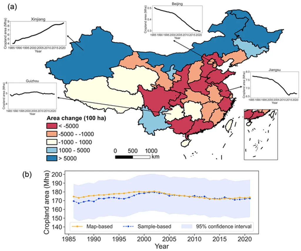
The study reveals that while all datasets show a stabilization of cropland area in China over recent decades, significant discrepancies exist, particularly at finer spatial scales and in ecologically sensitive regions. These discrepancies are not merely academic; they have real-world impacts on the diagnosis of spatial conflicts between cropland and habitat areas. “The discrepancies in cropland mapping can lead to an underestimation of the threats posed by cropland expansion to habitats of threatened species,” explains Ou. This underestimation can have commercial implications for the agriculture sector, as it may influence policy decisions and investment strategies related to land use and conservation.
The research also highlights that regions with greater cropland mapping discrepancies tend to exhibit lower environmental stability. This finding underscores the need for selecting regionally appropriate cropland datasets when assessing historical and current cropland distributions and their ecological consequences. For the agriculture sector, this means that accurate and reliable data is crucial for sustainable land management and biodiversity conservation.
The study offers insights into how remote sensing technologies can be better leveraged for ecological and agricultural sustainability research. As the world grapples with the challenges of feeding a growing population while preserving biodiversity, the findings of this research are particularly timely. They call for a more nuanced approach to cropland mapping, one that takes into account the unique ecological and environmental contexts of different regions.
In the words of Ou, “Our findings highlight the need for selecting regionally appropriate cropland datasets when assessing historical and current cropland distributions and their ecological consequences.” This research not only advances our understanding of the interplay between agriculture and biodiversity but also paves the way for more informed decision-making in the agriculture sector. As we move forward, the integration of accurate and reliable cropland data will be key to achieving sustainable agricultural practices and preserving the rich biodiversity of our planet.