In a significant stride towards enhancing agricultural monitoring and food security, researchers have unveiled CropLayer, a groundbreaking 2-meter resolution cropland map of China for the year 2020. This innovative tool, developed by leveraging Mapbox and Google satellite imagery, promises to revolutionize the way we understand and manage cropland distribution, with profound implications for the agriculture sector.
The study, published in *Earth System Science Data*, addresses a critical gap in the existing agricultural data landscape. “Accurate and detailed cropland maps are essential for food security,” explains lead author H. Jiang of the Guangdong Engineering Technology Research Center of Remote Sensing Big Data Application. “Yet, existing products for China exhibit substantial discrepancies. CropLayer aims to bridge this gap by providing a reliable, high-resolution baseline for agricultural structure analysis, yield estimation, and land use planning.”
The development of CropLayer involved a sophisticated three-stage framework. First, a ResNet model was employed for image quality assessment (IQA) to compensate for missing acquisition metadata. This step ensures that the data used is of the highest quality, a crucial factor for accurate cropland mapping. “We needed a robust way to assess the quality of the satellite imagery,” Jiang notes. “The ResNet model proved to be highly effective in this regard, allowing us to compensate for any missing metadata and ensure the integrity of our data.”
The second stage involved cropland extraction using an active learning strategy guided by a Mask2Former segmentation model and XGBoost-based semantic correctness evaluation. This innovative approach allows for precise identification of cropland areas, even in complex landscapes. “The active learning strategy was key to our success,” Jiang explains. “It enabled us to iteratively improve our model, ensuring that we captured the nuances of cropland distribution across China.”
The final stage integrated the results from Mapbox and Google using an XGBoost model informed by four feature groups: Geography, IQA, Regional Property, and Consistency. This integration ensures that the final map is not only highly accurate but also consistent across different regions and scales. “By combining data from multiple sources, we were able to create a map that is both detailed and reliable,” Jiang says.
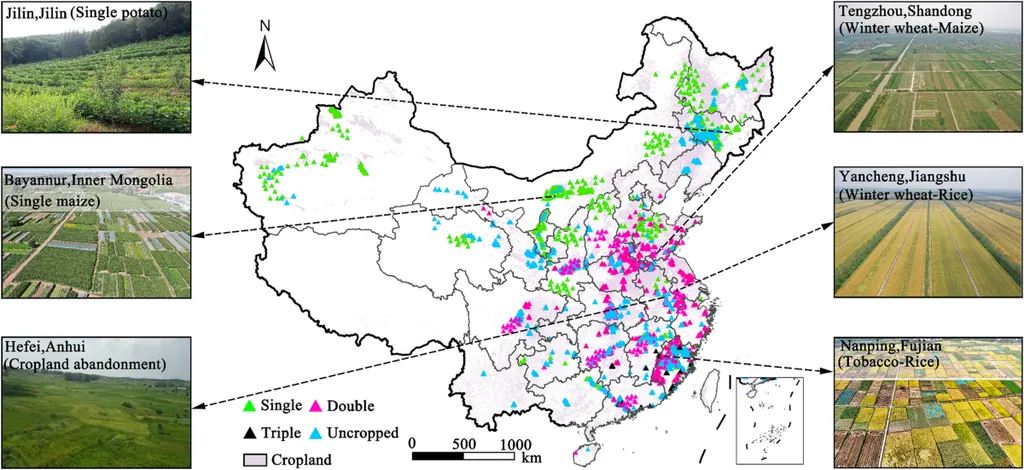
The results of this research are impressive. CropLayer achieves a pixel-level accuracy of 88.73%, a block-level semantic correctness of 96.5%, and provincial-level consistency, with 30 out of 32 provinces showing area estimates within ±10% of official statistics. In comparison, only 1–9 provinces meet this criterion across eight existing datasets. “These results demonstrate the superiority of CropLayer over existing products,” Jiang states. “We believe that this map will serve as a valuable resource for researchers, policymakers, and agricultural practitioners alike.”
The commercial impacts of this research are substantial. Accurate cropland maps are essential for a wide range of applications, from precision agriculture to land use planning. By providing a detailed and reliable map of cropland distribution, CropLayer can help farmers optimize their operations, reduce costs, and increase yields. It can also aid in the development of policies and strategies to promote sustainable agriculture and food security.
Looking ahead, the development of CropLayer is just the beginning. This research opens up new avenues for the use of satellite imagery and machine learning in agricultural monitoring. As Jiang notes, “The techniques we developed for CropLayer can be applied to other regions and contexts, paving the way for a new era of agricultural data analysis.”
In conclusion, the development of CropLayer represents a significant advancement in the field of agricultural monitoring. By providing a detailed and reliable map of cropland distribution, this innovative tool has the potential to revolutionize the way we understand and manage our agricultural landscapes. As we look to the future, the techniques and insights gained from this research will undoubtedly play a crucial role in promoting sustainable agriculture and food security.