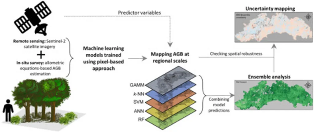
In the quest to bolster sustainable agricultural practices and accurately assess carbon stocks, a novel approach combining multi-source remote sensing data and machine learning has emerged, offering promising insights for large-scale biomass estimation in Mediterranean olive orchards. This innovative method, detailed in a recent study published in *Biogeosciences*, integrates data from GEDI LiDAR, optical sensors, SAR (Synthetic Aperture Radar), and topographic variables to predict Above-Ground Biomass Density (AGBD) with unprecedented scalability.
The research, led by F. Contreras from the Department of Soil and Water Conservation and Organic Waste Management at CEBAS-CSIC in Murcia, Spain, employs a Random Forest regression model implemented on Google Earth Engine (GEE). This model leverages GEDI L2A canopy height and dendrometric parameters to create a volumetric approach that can be applied across vast areas using satellite-based lidar technologies.
“The integration of these diverse data sources allows us to develop a more comprehensive and accurate model for biomass estimation,” Contreras explained. “This is crucial for understanding carbon stocks and supporting sustainable agricultural practices.”
The study found that the most effective predictions were achieved using a fully multi-source configuration, although the overall accuracy remained moderate due to sensor constraints and the exploratory nature of the framework. Key predictors identified in the model included NDBI (Normalized Difference Barren Index), slope, HV polarization, and MCARI1 (Modified Chlorophyll Absorption in Reflectance Index).
Spatially, the analysis revealed that Spain holds the highest total AGB stock among the studied countries, followed by Italy and Greece, reflecting their significant roles in olive production. This information is invaluable for agricultural stakeholders, as it provides a clearer picture of biomass distribution and carbon storage potential in these regions.
The commercial implications of this research are substantial. By offering a cost-effective and scalable strategy for large-scale carbon monitoring, the proposed framework supports data-driven agricultural management. This can lead to more informed decision-making, improved resource allocation, and enhanced sustainability in Mediterranean production systems.
“Understanding the distribution of biomass at a large scale is essential for optimizing agricultural practices and ensuring long-term sustainability,” Contreras noted. “This research provides a foundation for future developments in precision agriculture and carbon monitoring.”
While the study acknowledges limitations in precision at fine spatial scales, it demonstrates the potential of integrating LiDAR, optical, and SAR data to evaluate biomass distribution in low-stature vegetation. This exploratory study paves the way for future advancements in remote sensing technologies and their applications in agriculture.
As the agricultural sector continues to evolve, the integration of multi-source remote sensing data and machine learning models offers a powerful tool for promoting sustainable practices and accurate carbon stock assessment. The work of Contreras and his team represents a significant step forward in this field, with the potential to shape future developments in agritech and environmental monitoring.