In the lush, tropical landscapes of Kerala, India, groundwater is the lifeblood of agriculture, industry, and daily life. Yet, as demand grows and climate change alters rainfall patterns, understanding where to find this vital resource is becoming increasingly crucial. A recent study published in *Evolving Earth* offers a promising solution, using geospatial modeling to map groundwater potential zones with remarkable accuracy.
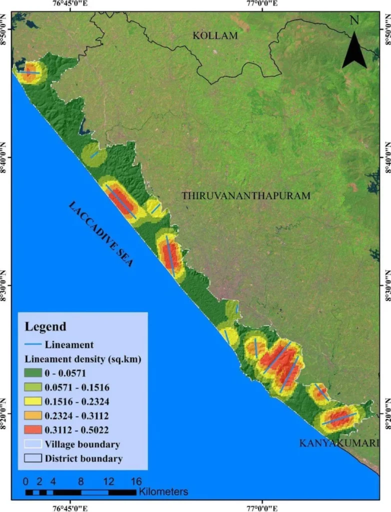
The research, led by I.S. Sreeja from the Department of Geology at the University of Kerala, focuses on the Palliman Watershed System (PWS), a coastal region in Kerala. The study employs a Geographic Information System (GIS) framework combined with the Analytical Hierarchy Process (AHP) to integrate twelve geo-environmental parameters—such as geology, land use, slope, and drainage density—to create a detailed groundwater potential zonation map. This map classifies the basin into five potential classes, with higher potential zones predominantly located in the midland and lowland regions.
What sets this study apart is its dual validation approach. The researchers compared their model’s predictions with actual groundwater yield data from seven observation wells and geophysical resistivity data from Vertical Electrical Sounding (VES) surveys. The results were impressive: 85.7% of the wells matched the predicted groundwater potential classes, and 84.6% of the VES soundings agreed with the mapped zones.
“This dual validation approach ensures the reliability of our model,” Sreeja explained. “It’s not just about predicting where groundwater might be; it’s about confirming those predictions with real-world data.”
For the agriculture sector, the implications are significant. Farmers in Kerala, like those in many tropical regions, rely heavily on groundwater for irrigation. Accurate groundwater potential maps can help farmers make informed decisions about where to plant crops, how to manage water resources, and how to invest in infrastructure. “This research can guide farmers to areas with higher groundwater potential, reducing the risk of crop failure due to water scarcity,” Sreeja noted.
Moreover, the study’s methodology is cost-effective and replicable, making it a valuable tool for other regions with similar hydrogeological conditions. “Our framework can be easily transferred to other tropical coastal settings with minor local calibration,” Sreeja said. This adaptability could revolutionize groundwater management in regions where water scarcity is a growing concern.
The study’s findings also have broader implications for water resource management and policy. By identifying recharge-prone zones, policymakers can prioritize areas for conservation and sustainable water use. This proactive approach can help mitigate the impacts of climate change and ensure water security for future generations.
As the world grapples with the challenges of water scarcity and climate change, innovative solutions like this one are more important than ever. By combining advanced geospatial modeling with robust validation techniques, researchers are paving the way for more sustainable and efficient water management practices. This study not only advances our understanding of groundwater potential but also offers a practical tool for farmers, policymakers, and communities to secure this vital resource for the future.