In the heart of Ethiopia’s semi-arid Awash River Basin, a groundbreaking study is offering new hope for sustainable water management and agricultural growth. The Kesem sub-basin, a region grappling with water scarcity and heavy reliance on groundwater, is the focus of innovative research that could reshape how we approach rainwater harvesting and groundwater recharge.
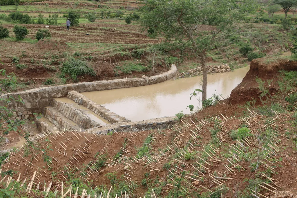
A team of researchers, led by Demelash D. Abadefar from the Water Resource and Irrigation Engineering Department at Woldia University, has developed an integrated approach to identify optimal sites for percolation tanks. These tanks are designed to capture and store rainwater, allowing it to percolate into the ground and replenish aquifers. The study, published in the Journal of Hydrology: Regional Studies, combines Geographic Information System (GIS), remote sensing (RS), the Soil and Water Assessment Tool (SWAT), and the Fuzzy Analytical Hierarchy Process (FAHP) to evaluate thirteen critical factors, from rainfall and runoff to soil texture and proximity to settlements.
The research highlights the importance of data-driven decision-making in water management. “By integrating multiple data sources and advanced modeling techniques, we can pinpoint the most suitable locations for percolation tanks with a high degree of accuracy,” explains Abadefar. This precision is crucial for maximizing the effectiveness of water harvesting efforts and ensuring sustainable groundwater recharge.
The study’s findings are particularly significant for the agricultural sector, which is the backbone of many economies in semi-arid regions. By enhancing groundwater recharge, farmers can secure a more reliable water supply for irrigation, leading to increased crop yields and improved food security. “This research provides a practical decision-support tool that can guide water management and rainwater harvesting planning,” says Abadefar. “It offers a scientifically validated basis for groundwater recharge enhancement, which is essential for supporting agricultural activities and ensuring long-term sustainability.”
The integrated approach developed by Abadefar and his team not only offers immediate benefits but also sets the stage for future advancements in the field. The combination of GIS, RS, SWAT, and FAHP demonstrates the power of interdisciplinary research and the potential of data-driven solutions to address complex environmental challenges. As technology continues to evolve, the integration of even more sophisticated tools and techniques could further refine our understanding of hydrological processes and improve water management strategies.
The study’s spatial prioritization reveals that only a small portion of the Kesem sub-basin is classified as very highly suitable for percolation tanks, while larger areas fall within the high, moderate, low, and very low suitability classes. This detailed mapping provides a clear roadmap for stakeholders, enabling them to prioritize investments and efforts in the most promising locations.
As the world grapples with the impacts of climate change and growing water scarcity, the insights gained from this research are more relevant than ever. By embracing innovative technologies and data-driven approaches, we can develop more resilient and sustainable water management strategies that support agricultural growth and ensure the well-being of communities in semi-arid regions. The study by Abadefar and his team serves as a testament to the power of interdisciplinary research and the potential of integrated approaches to address some of the most pressing challenges of our time.