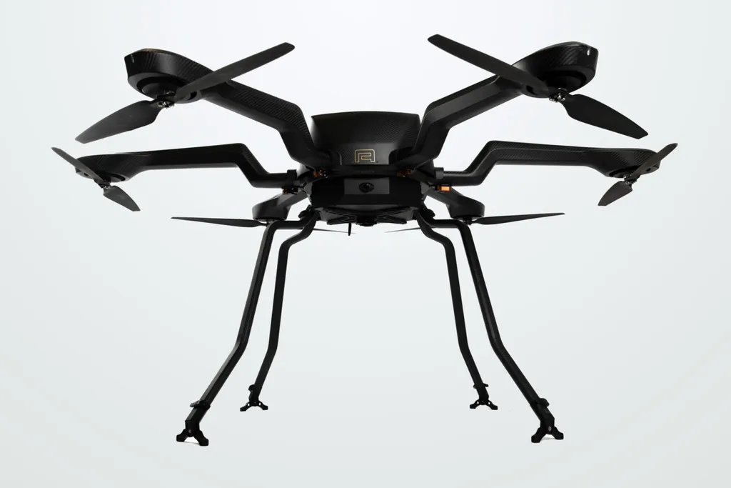
In the ever-evolving landscape of environmental monitoring and coastal management, a groundbreaking development has emerged from the National Institute of Ocean Technology (NIOT), Ministry of Earth Sciences. Researchers have designed and customized a heavy-lift hexacopter drone, weighing 22 kg, specifically tailored for marine and atmospheric applications. This innovative unmanned aerial vehicle (UAV) is poised to revolutionize the way we collect oceanographic data and monitor coastal regions, with significant implications for the agriculture sector as well.
The hexacopter drone, equipped with a suite of advanced sensors and technologies, including conductivity, temperature, and depth (CTD) sensors, multi-parameter sensors, an automatic seawater sampler, and light detection and ranging (LiDAR) technology, represents a leap forward in sustainable UAV design. “This drone is not just about capturing data; it’s about doing so in a way that is efficient, reliable, and environmentally conscious,” said lead author Srinivasan R. from the National Institute of Ocean Technology, Velachery–Tambaram Main Rd., Narayanapuram, Pallikaranai, 600 100 Chennai, Tamil Nadu, India.
One of the most compelling aspects of this research, published in ‘Журнал інженерних наук’, is the use of computational fluid dynamics (CFD) simulations to analyze the drone’s aerodynamic performance. By performing transient propeller-induced flow (PIF) studies under varying wind conditions, researchers were able to gain valuable insights into the drone’s stability and energy demands in dynamic marine environments. “Understanding how our drone behaves in different wind conditions is crucial for ensuring its reliability and effectiveness in the field,” Srinivasan R. explained.
The findings of this study have significant implications for the agriculture sector, particularly in the realm of precision agriculture. As the demand for sustainable and efficient farming practices grows, the use of drones for environmental monitoring and data collection becomes increasingly important. The hexacopter drone’s ability to collect oceanographic data and map coastal topography can provide valuable insights into soil health, water quality, and other environmental factors that impact agricultural productivity.
Moreover, the drone’s advanced sensor technology and LiDAR capabilities can be used to monitor crop health, detect pests and diseases, and optimize irrigation and fertilization practices. This can lead to increased crop yields, reduced water usage, and minimized environmental impact, ultimately contributing to more sustainable and profitable farming practices.
The research also highlights the importance of CFD for sustainable aerodynamic optimization in UAV design. By understanding the aerodynamic behavior of drones in different wind conditions, researchers can develop more efficient and reliable UAVs for a wide range of applications, from environmental monitoring to search and rescue operations.
As the agriculture sector continues to evolve and adapt to the challenges of climate change and resource scarcity, the use of advanced technologies like UAVs will become increasingly important. The hexacopter drone developed by the National Institute of Ocean Technology represents a significant step forward in this regard, offering a reliable and efficient platform for environmental monitoring and data collection that can support sustainable agriculture and coastal management practices.
In the words of Srinivasan R., “This research is not just about developing a new piece of technology; it’s about creating a tool that can help us better understand and protect our environment, and support sustainable agriculture and coastal development.” As we look to the future, the insights and innovations presented in this study will undoubtedly shape the development of reliable drone-based platforms for a wide range of applications, contributing to a more sustainable and resilient world.