In the heart of Iraq’s Babil Governorate, a groundbreaking study is reshaping how we approach rural development, with significant implications for the agriculture sector. Researchers have established a spatial database that leverages multi-criteria evaluation (MCE) and geographic information systems (GIS) to identify optimal areas for development, offering a data-driven approach to rural planning.
The study, led by Rasha Q. Luaibi from the Center of Urban and Regional Planning for Postgraduate Studies at the University of Baghdad, focuses on the Al-Musayyib and Al-Hashimiyah districts. By integrating various spatial criteria such as soil type, topography, natural resources, and proximity to infrastructure, the research provides a comprehensive assessment of each area’s potential.
“Combining spatial analysis and multi-criteria decision-making creates a strong basis for supporting rural planning policies,” Luaibi explains. This approach not only aids in the better allocation of resources but also ensures sustainable development in rural areas.
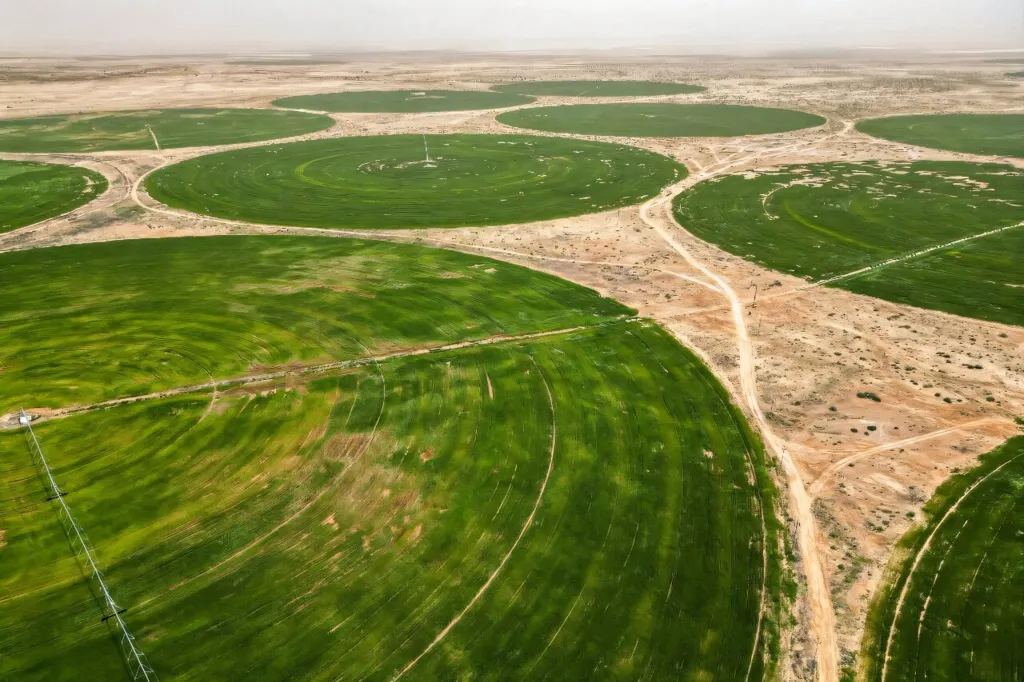
For the agriculture sector, the implications are substantial. The study revealed that Al-Musayyib district is particularly suitable for agricultural development due to its fertile alluvium soil and abundant water resources. This finding could guide farmers and investors towards more productive and sustainable agricultural practices, ultimately boosting yields and economic returns.
Moreover, the spatial database can serve as a crucial tool for local governments to make informed decisions about land use and resource allocation. “The recommended spatial database is an important tool for the local government to locate better allocation of resources and in protecting sustainable development in the village,” Luaibi notes.
The study, published in ‘Maǧallaẗ al-baṣraẗ al-ʻulūm al-zirāʻiyyaẗ’, highlights the potential of integrating advanced technologies like GIS and MCE in rural planning. As we look to the future, such data-driven approaches could become standard practice, shaping more efficient and sustainable rural development strategies worldwide.
This research not only provides valuable insights for Babil Governorate but also sets a precedent for other regions grappling with similar challenges. By harnessing the power of spatial databases and multi-criteria evaluation, we can pave the way for smarter, more sustainable rural development, benefiting both the agriculture sector and local communities.