In the midst of war, Ukraine’s agricultural sector has faced immense challenges, not least of which is the disruption of traditional methods of reporting and monitoring crop areas. A recent study published in *npj Sustainable Agriculture* offers a beacon of hope, demonstrating how remote sensing technology can fill critical data gaps and provide timely, transparent, and independent agricultural statistics.
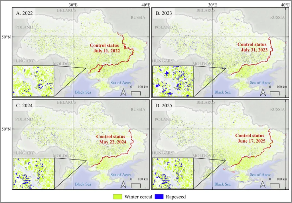
The research, led by Josef Wagner of ICube, University of Strasbourg, developed a fully remote sensing-based framework to estimate areas of two major crops, wheat and rapeseed, from 2022 to 2025. By leveraging Planet and Sentinel-1/2 imagery, the team applied clustering techniques to generate in-season crop type maps. These maps supported stratified random sampling in sample-based area estimation, using remotely interpreted reference data.
The results were striking. In Government-controlled areas, the estimates closely matched official statistics, with a root mean square error (RMSE) of 0.138 and 0.32 million hectares (Mha) for wheat and rapeseed, respectively. This accuracy is a testament to the robustness of the method. “Our findings underscore the critical role of remote sensing in providing timely, transparent, and independent agricultural statistics,” Wagner stated, highlighting the potential of this technology to support informed decision-making in food security and market stabilization.
The study also revealed significant trends in crop areas. Between 2022 and 2025, wheat area declined from 5.14±0.52 to 4.84±0.25 Mha in Government-controlled areas and from 2.06±0.16 to 1.55±0.09 Mha in Russian-held regions. Rapeseed expanded from 1.16±0.17 to 1.47±0.23 Mha in Government-controlled territories but collapsed in Russian-held areas, from 0.17±0.01 to 0.05±0.01 Mha. These insights are invaluable for understanding the impact of conflict on agricultural production and for planning future interventions.
The commercial implications of this research are substantial. Accurate and timely agricultural statistics are essential for market stability, trade, and investment. In a conflict zone like Ukraine, where traditional data collection methods are disrupted, remote sensing offers a reliable alternative. This technology can help farmers, agribusinesses, and policymakers make informed decisions, ultimately contributing to food security and economic stability.
Looking ahead, this research could shape future developments in the field of agricultural monitoring. As remote sensing technology continues to advance, its applications in agriculture are likely to expand. From precision farming to disaster management, the potential is vast. Wagner’s work serves as a powerful example of how innovation can address real-world challenges, even in the most trying circumstances.
In a world grappling with the impacts of climate change, conflict, and population growth, the need for reliable agricultural data has never been greater. This study not only fills critical data gaps in Ukraine but also paves the way for similar approaches in other regions facing similar challenges. As we look to the future, the role of remote sensing in agriculture is set to grow, offering new opportunities for sustainable and resilient food systems.