In the heart of Nigeria, where the sun blazes and the wind whispers through the savannah, a new study is shedding light on the untapped energy potential of the Federal Capital Territory (FCT). Researchers have turned to Geographical Information Systems (GIS) to map out the best spots for renewable energy deployment, offering a beacon of hope for rural communities grappling with electricity access challenges.
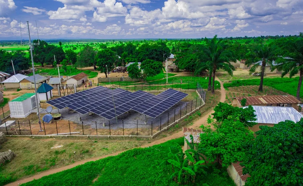
The study, published in *Academia Green Energy*, reveals a promising landscape for solar energy. “Solar irradiation data from PVGIS-SARAH3 satellite imagery shows that Bwari Area Council has the highest solar potential, with annual irradiation between 1915.96 and 1936.8 kWh/m2,” explains lead author Mika Paul Ibrahim from the Emerald Energy Institute, University of Port Harcourt. This is a game-changer for local agriculture, where reliable energy can power irrigation systems, cold storage, and processing facilities, boosting productivity and reducing post-harvest losses.
But the sun isn’t the only player in this energy revolution. The study also evaluated wind and biomass resources. While wind energy potential is generally low, with Bwari registering the highest average speed of 1.83 m/s, biomass resources are abundant in Gwagwalada, Kwali, and Abaji Local Government Areas. “Daily biomass availability ranges from 2 to 8 tons,” Ibrahim notes, highlighting the potential for agro-industrial waste to fuel local energy needs.
The commercial implications for the agriculture sector are substantial. With targeted renewable energy deployment, farmers can reduce their dependence on expensive and unreliable diesel generators. This shift can lower operational costs, increase profits, and foster sustainable agricultural practices. Moreover, the integration of renewable energy can attract investors to the sector, driving rural development and creating jobs.
The study’s GIS-based Multi-Criteria Decision Analysis (MCDA) approach offers a valuable decision-support tool for policymakers and investors. By identifying the most viable locations for renewable energy deployment, it paves the way for strategic planning and targeted interventions. As Ibrahim puts it, “GIS-based suitability analysis provides a valuable decision-support tool for policymakers and investors, promoting targeted renewable energy deployment and sustainable rural electrification in Nigeria.”
Looking ahead, this research could shape future developments in the field by demonstrating the power of GIS and MCDA in energy planning. It sets a precedent for similar studies across Nigeria and other countries with untapped renewable energy potential. As the world grapples with climate change and energy access challenges, such studies offer a roadmap for sustainable development and a brighter future for rural communities.