In the quest for more efficient and accurate agricultural practices, researchers have been exploring the potential of unmanned aerial vehicles (UAVs) equipped with advanced imaging technology. A recent study published in *Drones* sheds light on the comparative effectiveness of multi-spectral and RGB imagery for cropland mapping in smallholder farms, offering valuable insights for the agriculture sector.
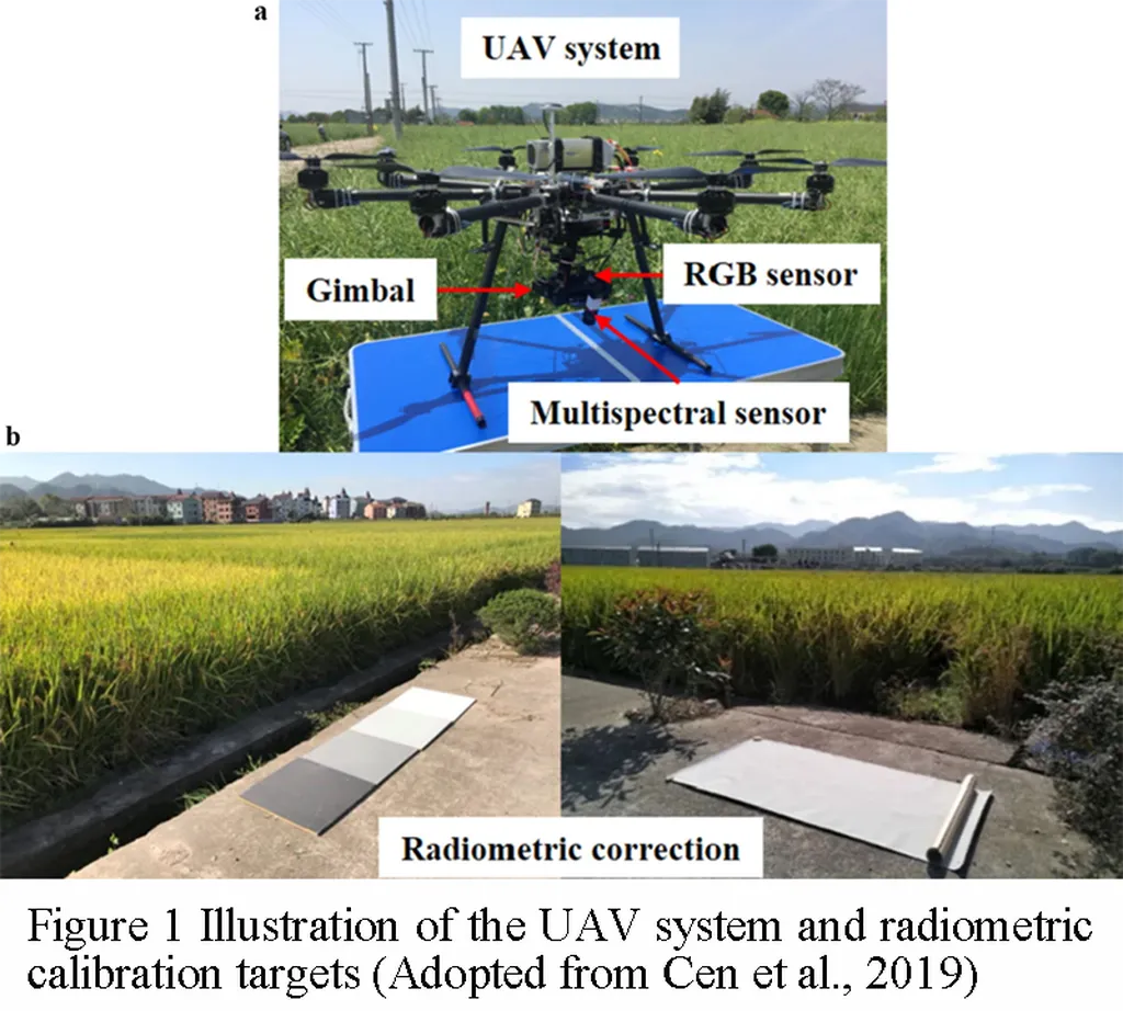
The study, led by Evania Chetty from the Centre for Water Resources Research at the University of KwaZulu-Natal, evaluated the performance of Red, Green, Blue (RGB) and multi-spectral imagery acquired using a MicaSense Altum sensor mounted on a DJI Matrice 300 UAV. The research aimed to determine which type of imagery provides better accuracy for cropland classification, a critical factor for effective land management and resource allocation.
Chetty and her team employed machine learning algorithms within the Google Earth Engine (GEE) platform to classify land cover into five categories and to distinguish cropland from non-cropland areas. The results were compelling: multi-spectral imagery outperformed RGB imagery in non-binary classification, achieving an overall accuracy of 75% compared to 68%. However, for binary cropland classification, the difference was less pronounced, with RGB imagery achieving an area under the receiver operating characteristic curve (AUC–ROC) of 0.75, just slightly lower than the 0.77 achieved by multi-spectral imagery.
“While multi-spectral data provides improved classification performance, RGB imagery can achieve comparable accuracy for fundamental cropland delineation,” Chetty noted. This finding is significant for the agriculture sector, particularly in resource-constrained contexts where multi-spectral sensors may not be readily available or affordable.
The implications of this research are far-reaching. For smallholder farmers, accurate cropland mapping can lead to better resource management, increased agricultural productivity, and ultimately, enhanced food security. The study suggests that RGB imagery, which is more accessible and cost-effective, can be a viable alternative for basic cropland mapping, democratizing access to precision agriculture technologies.
As the agriculture sector continues to evolve, the integration of UAV technology and machine learning algorithms holds immense potential. This research not only provides a baseline for the relative performance of RGB and multi-spectral UAV imagery but also paves the way for further investigation into RGB-based approaches. Future developments may see the widespread adoption of UAVs equipped with RGB sensors, making precision agriculture more accessible to smallholder farmers and contributing to sustainable agricultural practices.
In the words of Chetty, “This study supports further investigation of RGB-based approaches in resource-constrained agricultural contexts, offering a promising avenue for enhancing agricultural productivity and food security.” As the field continues to advance, the insights gained from this research will undoubtedly shape the future of precision agriculture, driving innovation and efficiency in the agriculture sector.