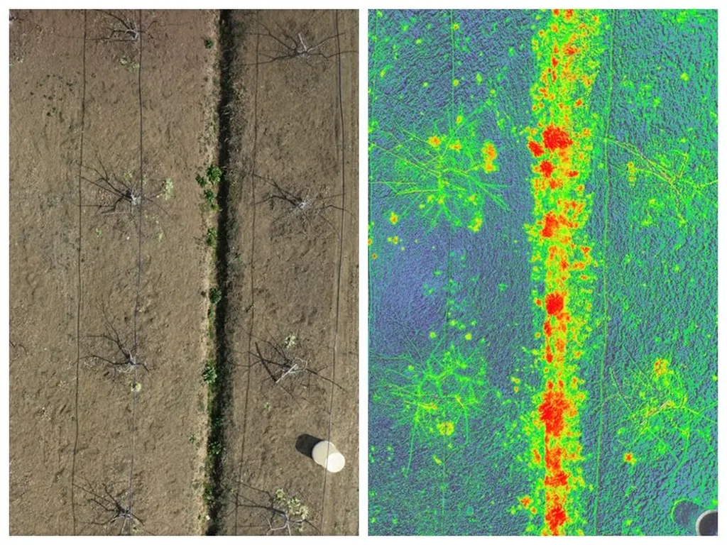
In the realm of remote sensing and precision agriculture, high-resolution images are the gold standard for gathering crucial data. However, the challenge of super-resolution reconstruction—enhancing the resolution of an image—often results in over-smoothed textures and structural distortions, which can obscure important details. A groundbreaking study published in the *IEEE Journal of Selected Topics in Applied Earth Observations and Remote Sensing* introduces a novel approach to tackle this issue, with significant implications for the agriculture sector.
The research, led by Yu Yao from the College of Land Science and Technology at China Agricultural University, presents a remote sensing image super-resolution network called DTWSTSR. This model combines the Dual-Tree Complex Wavelet Transform and Swin Transformer, a fusion of frequency-domain and spatial-domain features that enhances the ability to reconstruct intricate textures. “By integrating these two techniques, we can achieve a more accurate and detailed representation of ground objects,” Yao explains.
The DTWSTSR model includes several innovative components designed to improve image reconstruction. A Dual-Tree Complex Wavelet Texture Feature Sensing Module (DWTFSM) integrates frequency and spatial features, while a Multiscale Efficient Channel Attention mechanism enhances attention to multiscale and global details. Additionally, the researchers designed a Kolmogorov–Arnold Network based on a branch attention mechanism to improve the model’s ability to represent complex nonlinear features.
During the training process, the team investigated the impact of hyperparameters and proposed a two-stage SSIM&SL1 loss function to reduce structural differences between images. The results were impressive: DTWSTSR outperformed existing mainstream methods under different magnification factors (×2, ×3, ×4), ranking among the top two in multiple metrics. For instance, at ×2 magnification, its PSNR value was 0.64–2.68 dB higher than that of other models. Visual comparisons demonstrated that the proposed model achieved clearer and more accurate detail reconstruction of target ground objects.
The implications for the agriculture sector are substantial. High-resolution remote sensing images are essential for precision agriculture, enabling farmers to monitor crop health, optimize irrigation, and manage resources more effectively. “This technology can provide farmers with more accurate and detailed images, leading to better decision-making and improved yields,” Yao notes. The model’s excellent generalization ability in cross-sensor image reconstruction further enhances its practical applications.
As the agriculture industry continues to embrace technology, advancements in remote sensing and image reconstruction will play a pivotal role in shaping the future of farming. The DTWSTSR model represents a significant step forward in this field, offering a powerful tool for enhancing the resolution and accuracy of remote sensing images. With further development and refinement, this technology has the potential to revolutionize precision agriculture, making it more efficient and sustainable.
The study, led by Yu Yao from the College of Land Science and Technology at China Agricultural University, was published in the *IEEE Journal of Selected Topics in Applied Earth Observations and Remote Sensing*, highlighting the ongoing innovation in the field of remote sensing and its transformative impact on agriculture.