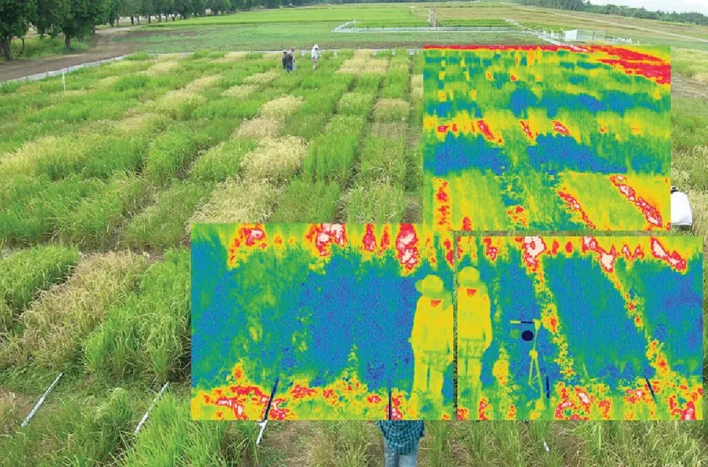
In the rapidly evolving world of precision agriculture, drones equipped with thermal cameras are becoming indispensable tools for monitoring crop health, detecting water stress, and optimizing irrigation strategies. However, the raw data collected by these unoccupied aerial vehicles (UAVs) often requires meticulous correction to ensure accurate land surface temperature (LST) measurements. A new R package, theRmalUAV, aims to streamline this process, making it more accessible to researchers and practitioners alike.
Developed by Christophe Metsu from the Division Forest, Nature and Landscape at KU Leuven in Belgium, theRmalUAV addresses a critical gap in the current workflow of thermal UAV data processing. “Converting raw thermal signals to quantitative land surface temperature values requires careful application of correction procedures,” Metsu explains. “Neglecting corrections for atmospheric effects and surface emissivity can lead to discrepancies of up to 5°C in the resulting LST estimate.”
The package offers two workflows: an orthomosaic-based approach that applies a single function to the entire dataset, and an image-based approach that accounts for variations in environmental conditions during the flight. This flexibility is particularly valuable in agriculture, where rapid changes in weather and illumination can significantly impact surface temperature measurements.
One of the standout features of theRmalUAV is its ability to correct for atmospheric effects, background temperature, spatial emissivity, and weather fluctuations. It also incorporates a novel method to handle rapid illumination changes, a common challenge in fieldwork. Currently, the package supports 11 common thermal sensors, including the research-grade TeAx ThermalCapture 2.0 and the commercially oriented DJI Mavic 3T.
The implications for the agriculture sector are substantial. Accurate LST measurements can help farmers detect early signs of water stress, optimize irrigation schedules, and improve overall crop management. “This tool can significantly enhance the precision and efficiency of agricultural practices,” says Metsu. “By providing accurate and reliable temperature data, farmers can make more informed decisions, ultimately leading to better yields and resource management.”
TheRmalUAV also includes tools for data cleaning, co-registration, and reporting, making it a comprehensive solution for thermal UAV data processing. The package’s versatility is demonstrated through two distinct case studies, highlighting its potential applications in various environmental and ecological research areas.
Published in the journal ‘Methods in Ecology and Evolution’, theRmalUAV represents a significant advancement in the field of thermal remote sensing. Its user-friendly interface and robust correction procedures make it an invaluable tool for researchers and practitioners. As the agriculture sector continues to embrace technology, tools like theRmalUAV will play a crucial role in shaping the future of precision agriculture.
For those interested in exploring theRmalUAV further, comprehensive guidance and tutorials are available through the package vignette and its companion website. This innovative tool not only simplifies the data processing workflow but also ensures the accuracy and reliability of LST measurements, paving the way for more informed and effective agricultural practices.